T4K3.news
Hurricane Erin strengthens near the coast
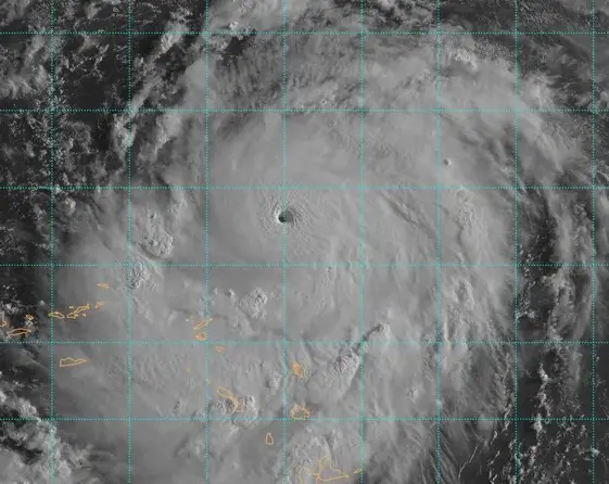
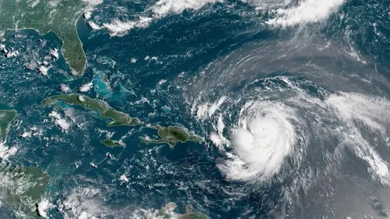
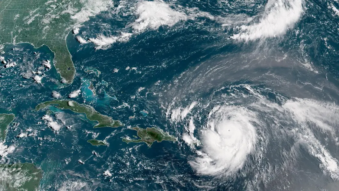
Erin reaches Category 5 while staying offshore; expect dangerous surf and rip currents along the Jersey Shore and Long Island next few days.

Erin strengthens to Category 5 and tracks offshore, with the Tri-State area facing dangerous surf and rip currents despite no landfall.
Hurricane Erin Pushes NYC Toward Coastal Risk as It Reaches Category 5
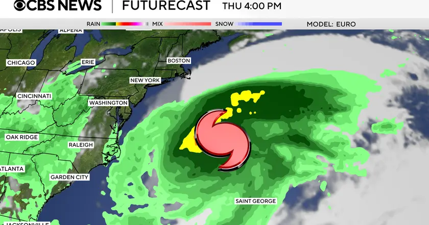
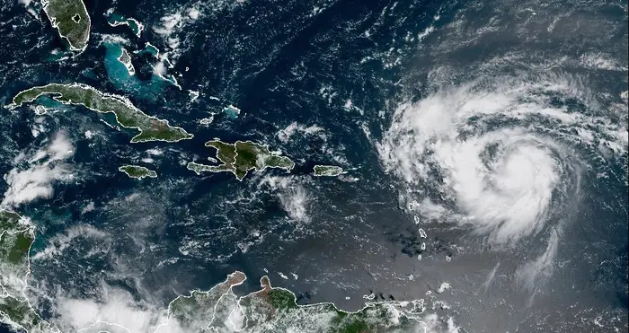
Hurricane Erin rapidly intensified into Category 5 on Saturday, the National Hurricane Center reports. The forecast keeps Erin on an offshore path along the East Coast, which lowers the chance of direct landfall but increases its size and reach. Coastal areas from New Jersey to Long Island could see dangerous rip currents, high surf, and beach erosion with winds forecast between 20 and 40 mph and waves up to 12 feet, mainly Tuesday through Thursday. Outer bands may bring a few rain showers, while inland zones such as the Hudson Valley and parts of Connecticut likely experience clouds and breezy conditions.
This is not the first time Erin has come close to New York City. The name has been reused since the late 1980s because most Erin storms do not cause enough damage to retire the name. The pattern shows that even storms that stay offshore can disrupt coastal life and the summer economy by affecting beaches, tourism, and local traffic.
Key Takeaways
"Rip currents do not respect maps or tracks"
Coastal danger warning
"Stay off the water until local advisories say it is safe"
Public safety guidance
"Offshore or not the coast feels the storm pull"
Editorial reflection on offshore tracks
"Prepare now not later that is smart coastal behavior"
Preparedness stance
The offshore track is a common pattern that tests coastal readiness. The main danger is not a direct hit but dangerous currents and coastal erosion that affect beaches and shore infrastructure. Officials must balance clear warnings with practical guidance so residents do not ignore alerts while living near the shore.
The naming history of Erin shows how memory shapes public response. The article highlights the need for clear, consistent messages about safety and timing. As climate patterns shift, messages that inform without panicking matter more than ever.
Highlights
- Rip currents do not respect maps or tracks
- Stay off the water until local advisories say it is safe
- Offshore or not the coast feels the storm pull
- Prepare now not later that is smart coastal behavior
Coastal hazard risk for Tri-State area
The forecast for Erin includes dangerous rip currents and beach erosion even without landfall. The risk to coastal infrastructure and public safety warrants heightened awareness and adherence to advisories.
The coast will watch Erin and update plans as forecasts evolve.
Enjoyed this? Let your friends know!
Related News
Hurricane Erin strengthens to Category 4
Erin set to strengthen into major hurricane
Hurricane Erin Rapidly Intensifies
Hurricane Erin Threat Grows
Hurricane Erin strengthens toward major hurricane
Erin Could Become First Hurricane This Weekend

Tropical Storm Erin forms in Atlantic
Hurricane Erin forms in Atlantic