T4K3.news
Hurricane Erin Threat Grows
Erin strengthens rapidly near the Caribbean and poses a major threat to islands and the Atlantic coast; warnings and preparations are in motion.


A rapid hurricane intensification near the Caribbean raises warnings for nearby islands and coastal regions.
Erin Surges to Cat 5 and Maintains Threat to Caribbean and Atlantic Coast
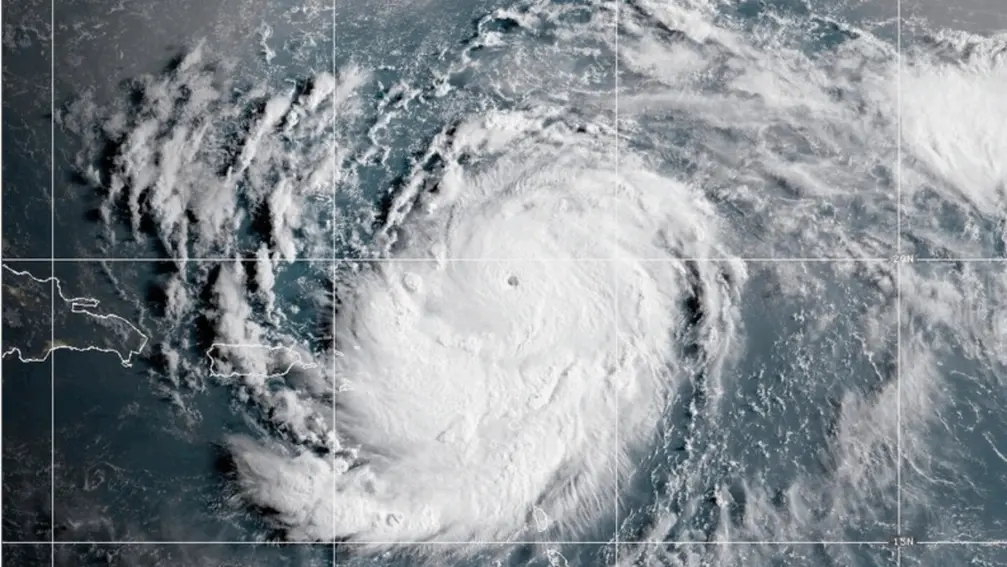
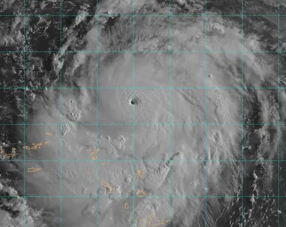
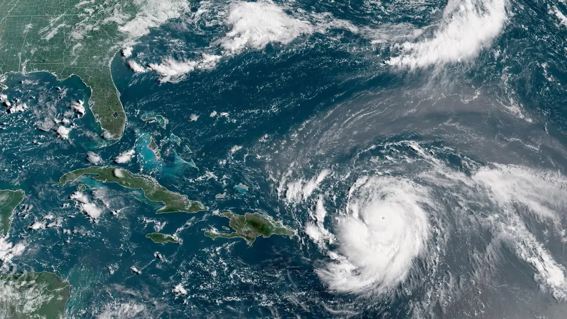
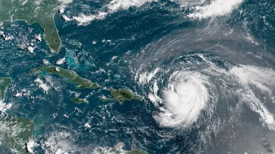
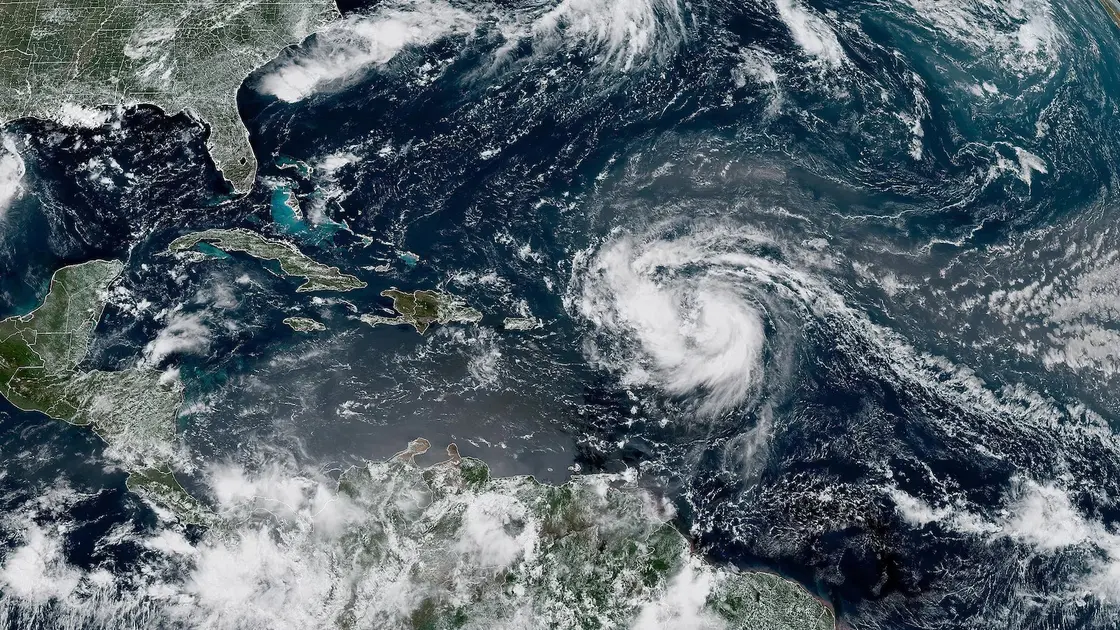
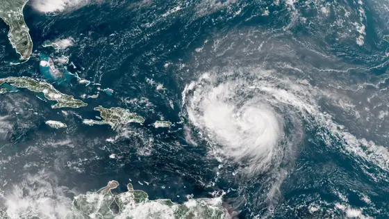
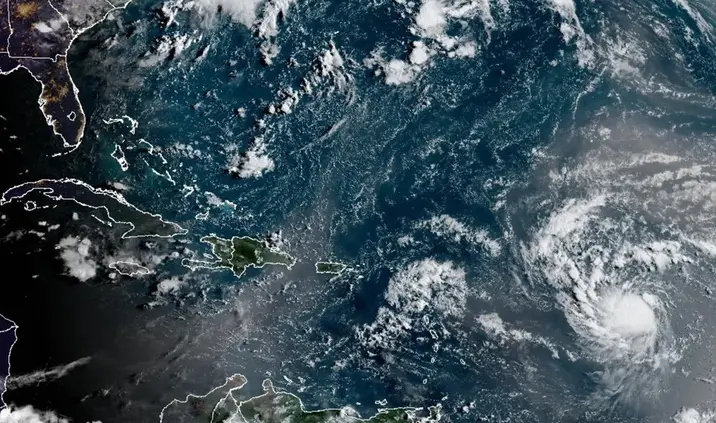
Erin intensified from 100 mph to 160 mph in 24 hours as it moved west past the Leeward Islands. The storm reached Category 5 before weakening slightly to 140 mph, leaving it still a major hurricane. The system is compact, with hurricane-force winds extending about 30 miles from its center.
Though forecasts do not show landfall, Erin will generate life threatening surf and heavy rain. The track suggests the Bahamas, parts of the US East Coast and Atlantic Canada could face dangerous conditions as the system moves north. The U.S. government has deployed more than 200 personnel to Puerto Rico as a precaution while flood watches remain in effect. Scientists note that warmer ocean waters and higher atmospheric moisture help drive rapid intensification in the Atlantic.
Key Takeaways
"Erin is compact in size with hurricane-force winds extending 30 miles from its center"
NHC description of Erin's footprint
"Storms that ramp up so quickly complicate forecasting and emergency planning"
Editorial note on forecasting challenges
"Heavy rain could cause flash floods, landslides and mudslides"
NHC warning for affected areas
"Scientists link rapid intensification to warmer Atlantic waters and climate change"
Scientific context mentioned in coverage
Erin highlights how quickly a storm can evolve, testing the speed of warnings and the ability of communities to react. Forecasts still struggle when a system strengthens overnight, leaving planners with a narrow window to issue evacuations and allocate resources.
The episode pushes policymakers to think about resilience, cross jurisdiction coordination, and how to communicate risk clearly to the public. It also underscores the public’s desire for timely updates and concrete guidance when a threat shifts from potential to imminent, even when the particular track remains uncertain.
Highlights
- Heat in the sea writes its own forecast
- Time is the enemy when a storm spikes overnight
- A compact storm can bring broad damage in a short window
- Warnings that arrive late are not warnings at all
Climate risk and preparedness concerns
The rapid intensification and cross border impact raise questions about funding for readiness, clear public guidance, and cross jurisdiction response.
As Erin moves north, communities must stay prepared and informed.
Enjoyed this? Let your friends know!
Related News
Hurricane Erin strengthens to Category 4
Hurricane Erin Category 5 reached
Hurricane Erin Rapidly Intensifies
Erin becomes first Atlantic hurricane of season

Tropical Storm Erin forms in Atlantic
Hurricane Erin Update
Erin Could Become First Hurricane This Weekend

Hurricane Erin remains dangerous