T4K3.news
Erin set to strengthen into major hurricane
Forecasts show Erin strengthening in the Atlantic with possible impacts to Bermuda and coastal regions.

Forecasts indicate Erin will intensify into a major hurricane this weekend as it moves across the Atlantic.
Erin Poised to Grow Into Major Atlantic Hurricane
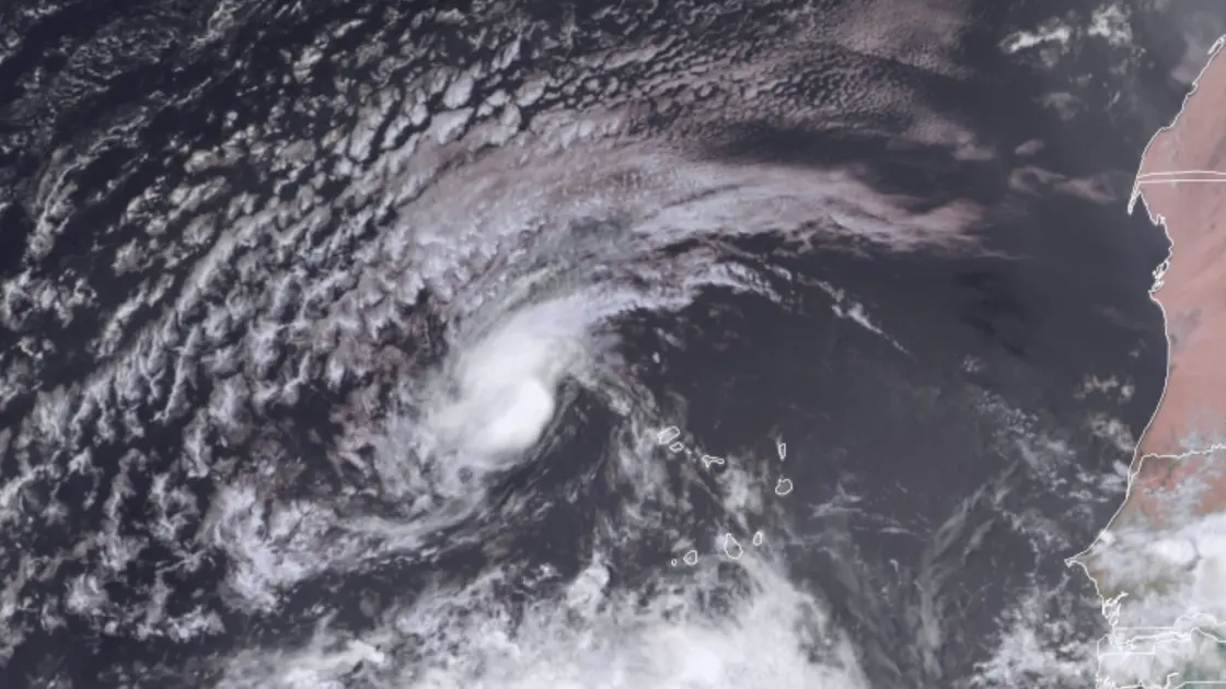
Tropical Storm Erin formed after crossing the Cabo Verde Islands and stands about 300 miles west-northwest of those islands, moving west at 20 mph with winds near 45 mph.
Forecasts show Erin likely to intensify in the coming days, with atmosphere that is moist and wind shear that remains light to moderate. Sea surface temperatures around 26 degrees Celsius (79 Fahrenheit) provide a basic fuel, and models point to warmer waters and higher heat content as Erin progresses toward the central Atlantic. Forecasters note that nighttime convection can boost development, a factor that helped Erin grow on Sunday night.
Most forecast models converge on a recurving path away from the U.S. East Coast, with Bermuda and north-facing Atlantic shores among the potential regions to feel swells and rip currents if Erin strengthens and tracks further north. Long-range uncertainty remains, so the exact track and peak intensity could still shift in the coming days.
Key Takeaways
"Erin is on a long Atlantic ride with a sharp turn ahead"
standalone quote reflecting uncertainty and horizon
"Forecasts converge on a northward bend, but the exact path remains a question"
comment on model agreement and uncertainty
"Warmer seas raise the stakes for coastal communities"
impact-focused remark
"Preparedness now saves lives when the Atlantic roars later"
call to action
This storm shows how early-season Atlantic activity can evolve quickly when conditions align. Forecasters emphasize ensemble agreement now, but stress that small changes in steering currents can alter Erin’s future path. The drift toward a northward bend, likely away from the United States, reflects a common pattern when a strong upper trough influences steering, yet the forecast remains risky in its precision days out.
The situation highlights the challenge of balancing public preparedness with the risk of overreaction. Coastal communities should monitor official updates, but avoid unnecessary alarm. The forecast also underscores how gradual warming of Atlantic waters can extend the potential for intensified storms later in the season, testing readiness across multiple regions and sectors.
Highlights
- Erin is on a long Atlantic ride with a sharp turn ahead
- Forecasts converge on a northward bend, but the exact path remains a question
- Warmer seas raise the stakes for coastal communities
- Preparedness now saves lives when the Atlantic roars later
Weather forecasts will continue to evolve as Erin moves across a warming Atlantic.
Enjoyed this? Let your friends know!
Related News

Erin poised to become first major hurricane of 2025 Atlantic season

Tropical Storm Erin forms in Atlantic

Tropical Storm Erin poised to become major hurricane

Erin update prompt

Transfer news intensifies as deadline approaches

Brewers claim top power ranking after trade deadline

Rematch updates now available on Xbox Game Pass

TSB sold to Santander as brand faces uncertain future
