T4K3.news
Erin Could Become First Hurricane This Weekend
Forecasts show Erin strengthening to a hurricane by Friday with potential impacts from swells and surf in the Leeward Islands and nearby regions.

Forecasts suggest Erin could intensify from tropical storm to hurricane by Friday and pose risky surf and swells for Caribbean islands and the Atlantic coast.
Erin expected to become season's first hurricane this weekend
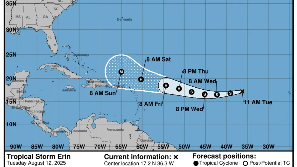
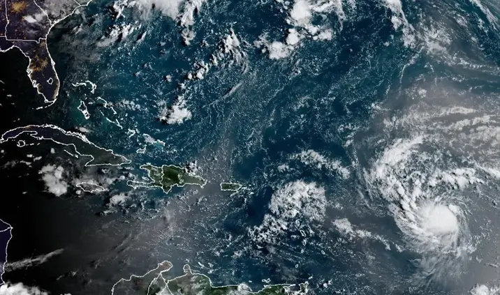
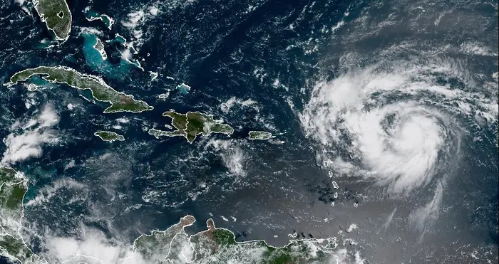
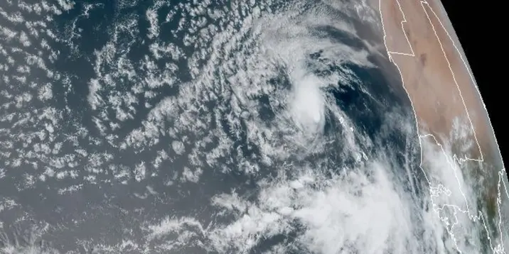
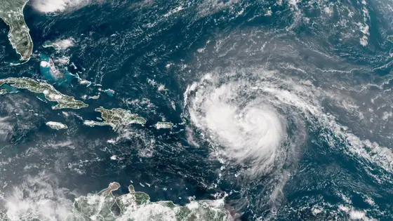
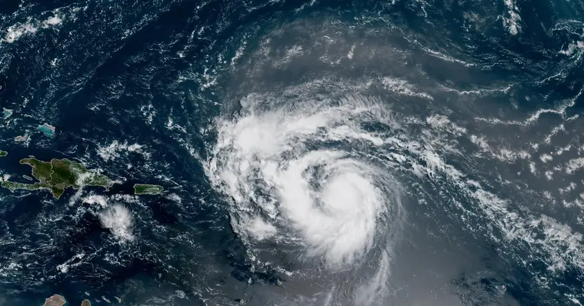
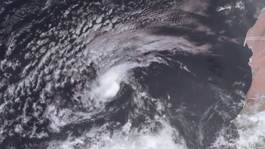
Tropical Storm Erin sits about 990 miles east of the northern Leeward Islands, moving west at 17 mph with maximum sustained winds near 50 mph. The National Hurricane Center projects Erin to become a hurricane by Friday and potentially reach major hurricane strength later this weekend, though the forecast track keeps the storm's center away from land for now. Tropical-storm-force winds extend about 60 miles from the center, and swells are expected to reach parts of the Leeward Islands, the Virgin Islands and Puerto Rico this weekend.
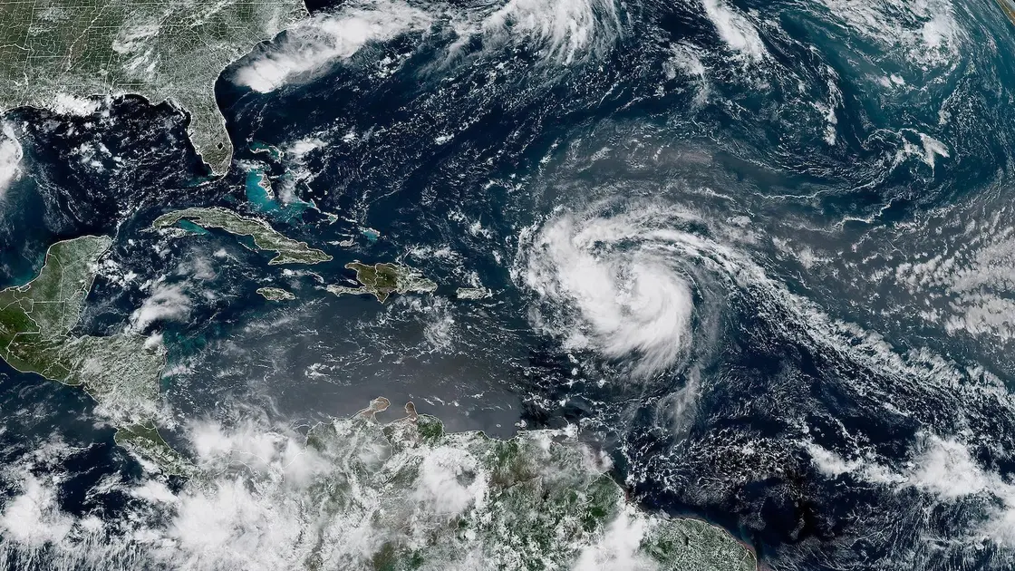
Forecasters say gradual strengthening is likely over the next day, with more significant intensification possible on Friday and Saturday. The forecast track would bring Erin to hurricane strength by Friday afternoon with about 80 mph winds, then to major hurricane strength early Sunday with winds around 115 mph and gusts near 140 mph. Warmer Atlantic waters and less wind shear could allow rapid intensification, while the forecast cone still carries uncertainty about land impacts. No watches or warnings are in place yet, but residents should monitor advisories as swells and surf risk increase. Separately, a broad area of low pressure in the Bay of Campeche has a 20% chance of development in the next two to seven days, possibly bringing rain to northeastern Mexico or southern Texas.
Key Takeaways
"This increasingly favorable environment could result in a period of rapid intensification."
NHC hurricane specialist Larry Kelly on Erin's forecast
"The center of Erin is likely to move near or just north of the northern Leeward Islands over the weekend."
Forecast track for Erin
"There continues to be confidence that Erin will be a large and powerful hurricane over the southwestern Atlantic Ocean this weekend."
Forecasters discussing Erin's strength
"Environmental conditions are marginally conducive for further development."
Forecast conditions described by forecasters
Forecasts show how hurricane forecasting hinges on water temperature, wind shear, storm size, and speed. Erin’s potential rapid intensification highlights the risk of surprises even when the center remains offshore. The current track favors offshore motion, but swells and gusty winds can still disrupt coastal areas and shipping lanes.
Beyond the science, the situation tests public communication and preparedness. The fatalities linked to earlier floods from this system’s path remind us that danger can arrive before a landfall. The best response is clear, timely information and readiness that turns warnings into action.
Highlights
- This environment could spark rapid intensification
- The center is likely to move near the Leeward Islands this weekend
- No watches or warnings yet but stay informed
- Large swells will affect coastlines this weekend
Public safety risk from approaching hurricane Erin
The forecast indicates Erin could strengthen into the season's first hurricane, with swells and dangerous surf posing hazards to Caribbean islands and parts of the US East Coast. Uncertainty remains about the exact track and intensity, which can delay protective actions. The episode also underscores the human cost of storms, given recent fatalities linked to related weather events.
As Erin moves, communities weigh risk and readiness.
Enjoyed this? Let your friends know!
Related News
Hurricane Erin strengthens toward major hurricane
Erin becomes first Atlantic hurricane of season
Erin poised to become first major hurricane of 2025 Atlantic season
Hurricane Erin Update
Hurricane Erin forms in Atlantic

Erin update prompt
Erin set to strengthen into major hurricane

Tropical Storm Erin forms in Atlantic