T4K3.news
Hurricane Erin forms in Atlantic
Erin becomes the first Atlantic hurricane of 2025 with a track that stays offshore of the U S coast for now

Erin strengthens into the first hurricane of the 2025 Atlantic season with forecasts showing a northward, offshore path.
Hurricane Erin forms in Atlantic as first 2025 season hurricane
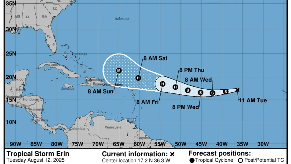
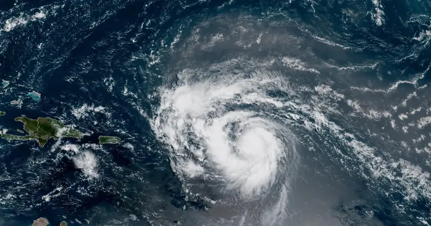
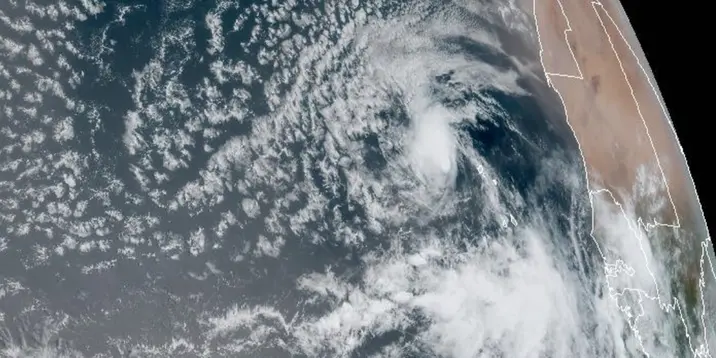
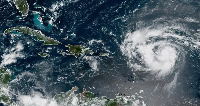
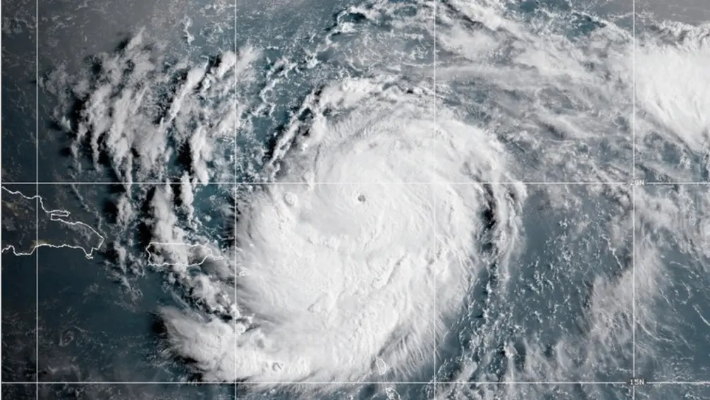
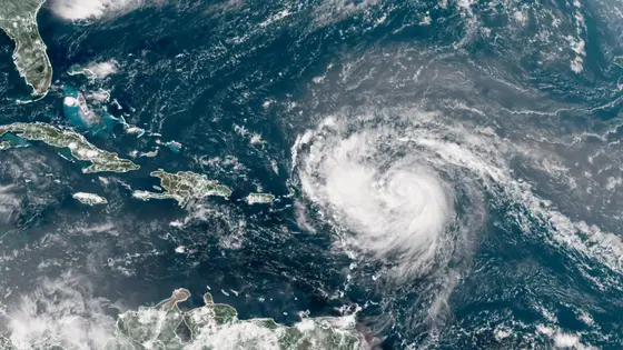
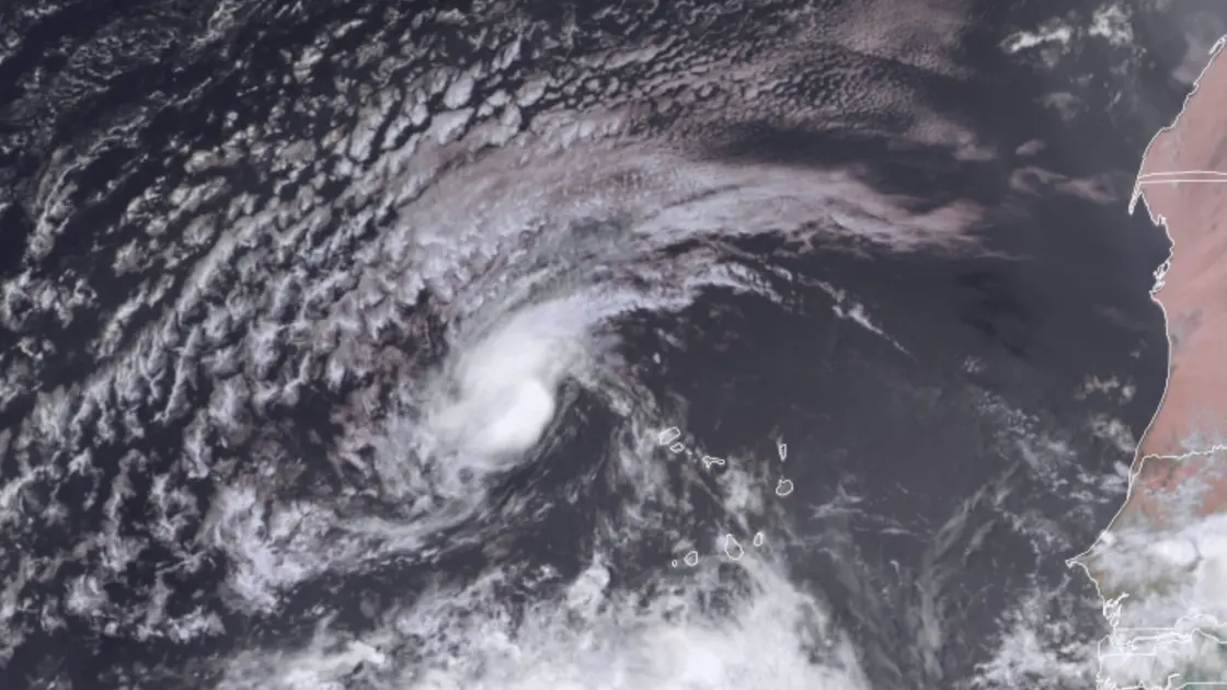
Erin strengthened into a hurricane Friday in the Atlantic. It is the first hurricane of the 2025 season and has maximum sustained winds of 75 mph, classifying it as a Category 1 storm. The center says Erin is about 460 miles east of the northern Leeward Islands and moving west-northwest at 18 mph. Forecasters expect Erin to strengthen and possibly reach major hurricane strength, though no U.S. landfall is currently forecast. Caribbean islands are urged to monitor Erin for heavy rainfall and dangerous surf and rip currents.
Key Takeaways
"Erin strengthens into a hurricane as forecasts call for a northward turn"
summary of Erin's status and track
"Caribbean communities must stay vigilant even when a storm stays offshore"
risk reminder for vulnerable areas
"NOAA expects an above normal season with several named storms"
seasonal forecast context
"Preparedness is the best defense against sudden storm changes"
general guidance for residents
Forecasts show Erin could curve north and stay well offshore of the U.S. East Coast, a pattern common when storms reach the higher latitudes. Spaghetti model maps illustrate a spread of possible tracks, most of which keep Erin away from populated shores for now. The season's early signs point to a busy year with several named storms, a reminder that even storms far offshore can disrupt travel and local economies. The broader context is clear: NOAA expects above normal activity between 13 and 18 named storms, with five to nine becoming hurricanes and two to five turning into major hurricanes. That mix means steady vigilance, especially for Caribbean communities that face rainfall, flooding risk, and coastal hazards even when a storm does not make direct landfall.
Highlights
- Preparedness is the best defense when the sea can flip to danger overnight
- Caribbean communities must stay vigilant even when a storm stays offshore
- A busy season is a test for local authorities and families alike
- Forecast maps show why offshore storms still demand caution
The weather calendar is just starting to turn, and preparations remain essential.
Enjoyed this? Let your friends know!
Related News
Tropical Storm Erin forms in Atlantic
Tropical Storm Erin poised to become major hurricane
Erin poised to become first major hurricane of 2025 Atlantic season
Hurricane Erin strengthens toward major hurricane
Hurricane Erin strengthens near Caribbean

Erin update prompt
Hurricane Erin Update
Erin set to strengthen into major hurricane