T4K3.news
Hurricane Erin strengthens near Caribbean
Erin rapidly intensified to Category 5 and stays offshore as authorities warn of heavy rain and rip currents.

Forecasters warn Erin rapidly intensified to Category 5 near the Caribbean and could bring heavy rain and coastal hazards.
Erin strengthens to Category 5 near Caribbean
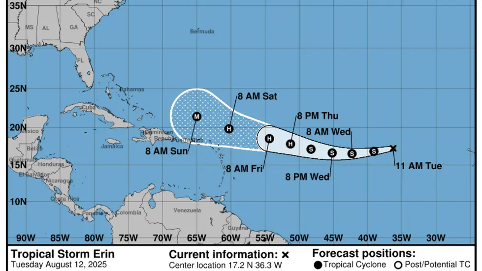
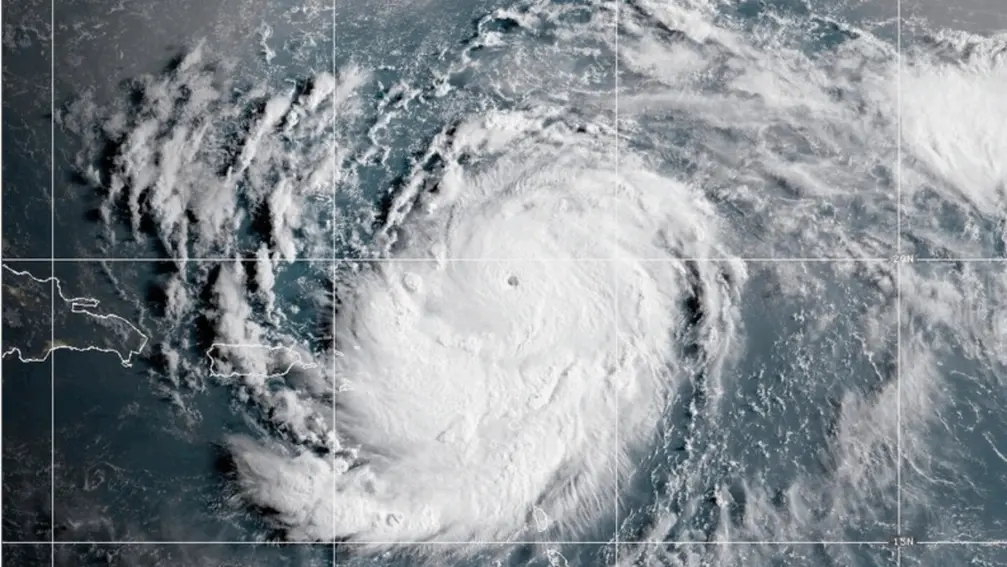
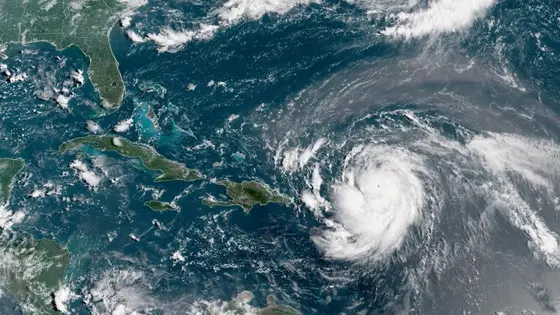
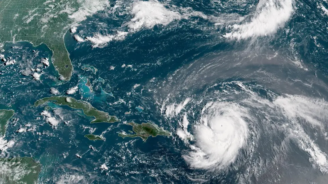
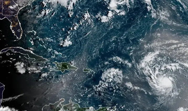
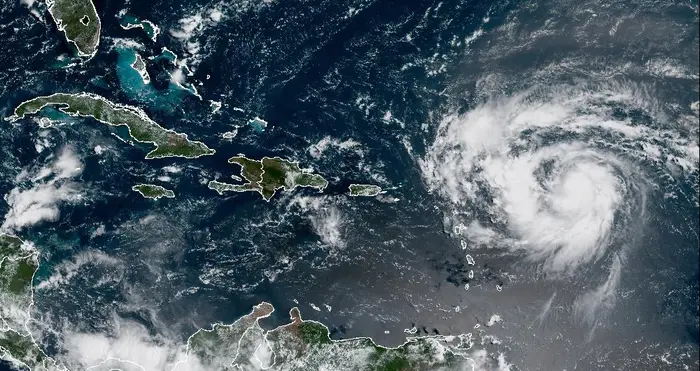
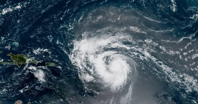
Hurricane Erin intensified from a tropical storm to Category 5 in 24 hours. Maximum winds reached 160 mph. The center said the storm would stay offshore, but its outer rain bands could bring heavy rain to the northeast Caribbean. Forecasters expect Erin to remain a major hurricane for several days even as it grows in size.
Puerto Rico and the Bahamas prepared shelters and deployed emergency teams. Tropical storm watches were issued for St Martin, St Barts and St Maarten. People visited beaches at times despite warnings as some kept to daily routines. The forecast track kept Erin north of land but the storm still threatens shipping, tourism and local infrastructure in the region.
Key Takeaways
"An incredible race from tropical storm to Category 5"
Michael Lowry on intensification pace
"Storms that ramp up so quickly complicate forecasting"
Michael Lowry
"Only four other Category 5 storms have formed in the Atlantic by mid August"
Dan Pydynowski
"Climate change makes rapid intensification more likely"
scientists cited in the article
Rapid intensification tied to warm ocean waters is a growing worry for forecasters. Erin shows how quickly a storm can surge from tropical to major status, making forecasts and warnings harder to act on. The Atlantic season is expected to be busy this year.
Officials face a balance between warning people and avoiding panic. Offshore paths complicate planning for shelters, budgets and transport. This event also underscores how climate change may push storms to intensify faster and widen their reach.
Highlights
- An incredible race from tropical storm to Category 5
- Storms that ramp up so quickly complicate forecasting
- Only four other Category 5 storms have formed in the Atlantic by mid August
- Climate change makes rapid intensification more likely
Hurricane Erin tests safety and planning budgets
The rapid intensification and offshore track place pressure on shelters, evacuations, and funding. Local authorities must manage shifting forecasts while maintaining public confidence and resource readiness.
Forecasts will evolve as Erin moves
Enjoyed this? Let your friends know!
Related News
Hurricane Erin Rapidly Intensifies
Hurricane Erin Threat Grows
Erin Could Become First Hurricane This Weekend

Tropical Storm Erin forms in Atlantic
Hurricane Erin strengthens toward major hurricane
Erin set to strengthen into major hurricane
Hurricane Erin forms in Atlantic

Erin reaches Category 4 in Caribbean