T4K3.news
Hurricane Erin Recurves Out to Sea
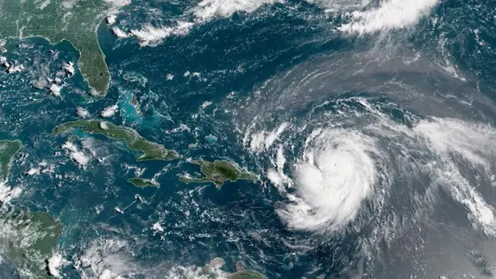
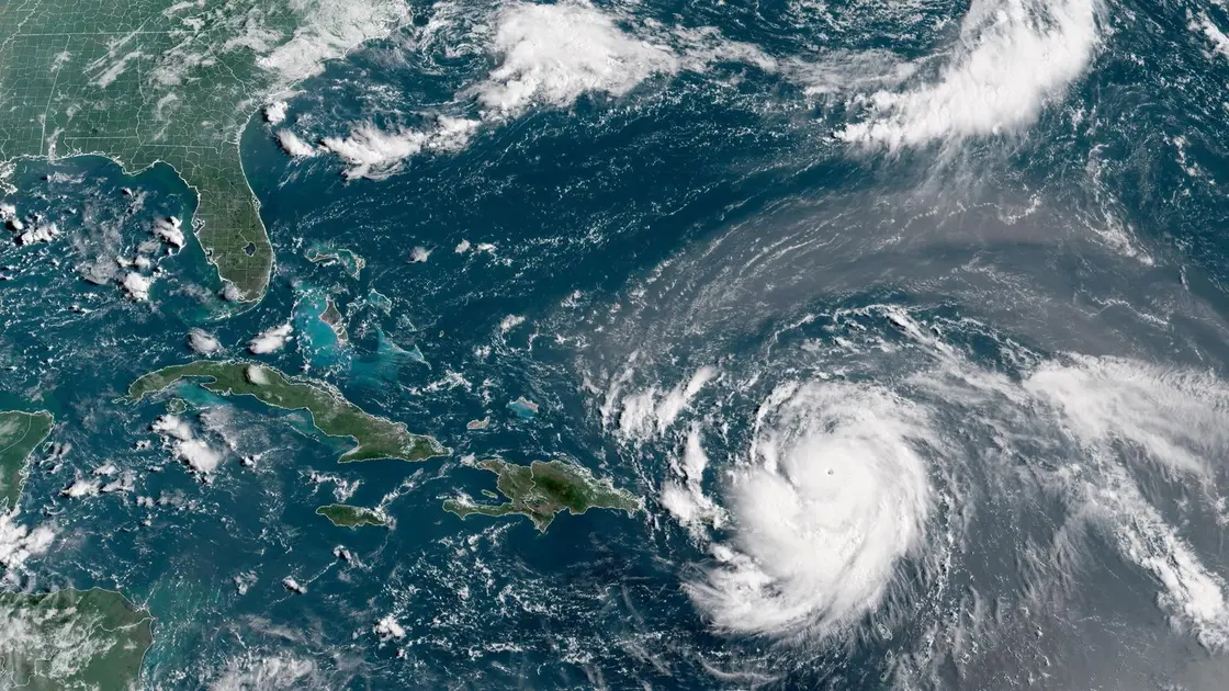
Erin moves toward a close pass off the U.S. East Coast with potential coastal impacts; forecasters expect a recurvature away from land.

Hurricane Erin strengthens and is forecast to recur northeastward after a close approach to the U.S. East Coast, while two tropical waves are watched for possible development.
Hurricane Erin Recurves Out to Sea
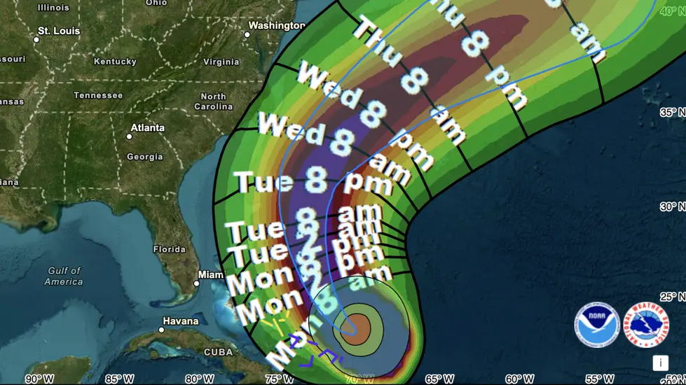
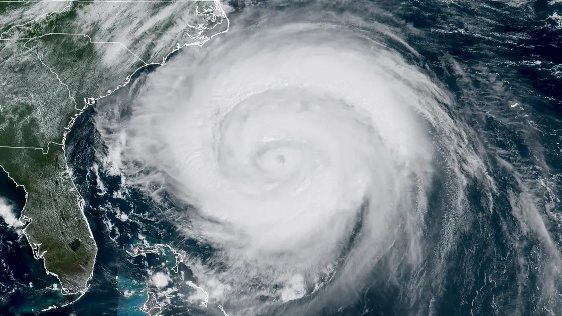
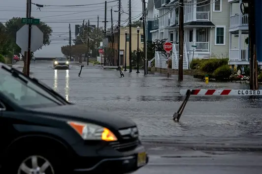
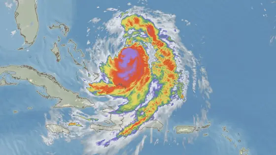
Tropical storm warnings are in effect for portions of the North Carolina and Virginia coasts as Hurricane Erin moves northward for a close pass near the Outer Banks on Thursday. At 2 p.m. EDT, Erin was about 335 miles south-southeast of Cape Hatteras, North Carolina, moving north at 13 mph with top winds near 110 mph and a central pressure of 943 mb. Forecasters say Erin’s size means large swells and dangerous rip currents along much of the East Coast, with a potential storm surge of two to four feet near high tides along parts of the North Carolina coast and Chesapeake Bay. The forecast track keeps Erin away from a direct landfall but still brings coastal erosion, road closures, and flood risk to vulnerable shorelines.
Key Takeaways
"Erin is truly an extraordinary hurricane, one of the biggest and most powerful we've seen in this part of the Atlantic."
meteorology expert quoted with emphasis on Erin's scale and strength
"The coast learns fast that large storms move slow and can surprise."
editorial takeaway on storm behavior
"Storm surge will be accompanied by large waves and could close roads."
NOAA warning quoted in the article
"Preparation beats panic when storms loom."
general safety guidance
The strength of Erin lies as much in its size as its wind. A sprawling storm can push dangerous surf far from the center, testing beaches and coastal infrastructure even as the eye stays offshore. That makes forewarned residents and visitors along the Outer Banks and nearby shores crucially aware of changing tides, waves, and currents. Forecasts stress that Erin is likely to weaken after Thursday as wind shear increases and cooler, drier air moves in, then transition to an extratropical cyclone by the weekend.
Highlights
- Erin is truly an extraordinary hurricane, one of the biggest and most powerful we've seen in this part of the Atlantic.
- The coast learns fast that large storms move slow and can surprise.
- Storm surge will be accompanied by large waves and could close roads.
- Preparation beats panic when storms loom.
Updates will refine Erin’s exact path and the level of coastal risk as forecasts evolve.
Enjoyed this? Let your friends know!
Related News
Erin set to strengthen into major hurricane
Hurricane Erin Update
Hurricane Erin Rapidly Intensifies
Hurricane Erin Category 5 reached
Coastal flood risk persists as Erin nears
Hurricane Erin danger grows on East Coast

Hurricane Erin prompts evacuations and dangerous waves

Hurricane Erin Threat Grows