T4K3.news
Hurricane Erin prompts evacuations and dangerous waves
Erin strengthens toward a large, powerful storm with dangerous surf and rip currents expected along the US East Coast, prompting evacuations and service disruptions.

Tropical storm conditions loom as Erin strengthens and threatens waves along the US East Coast.
Hurricane Erin prompts evacuations and dangerous waves along US coast
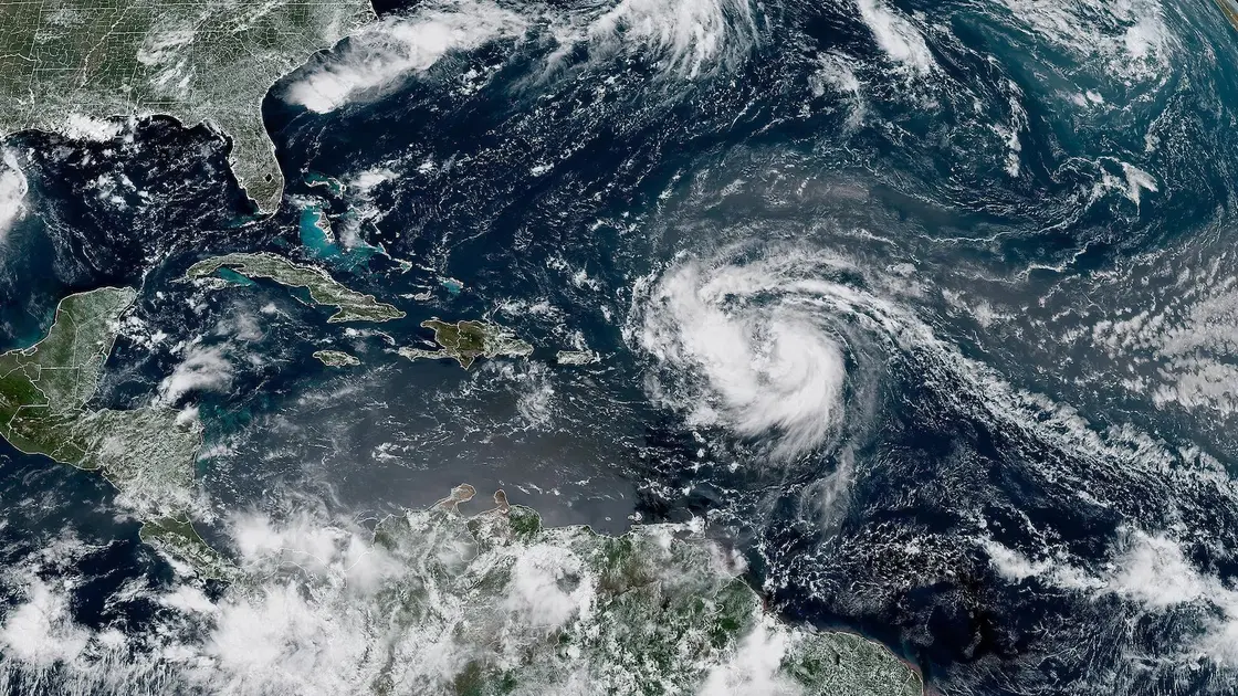
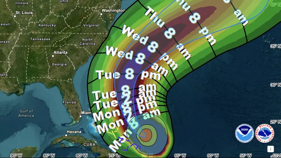
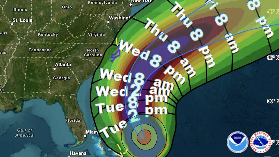
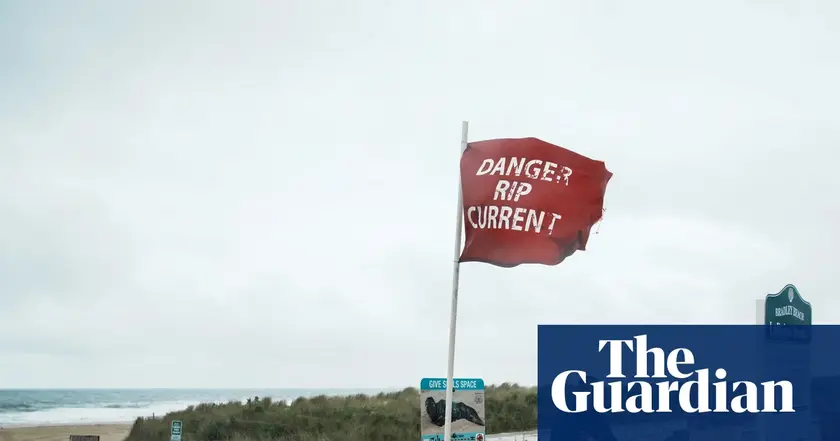
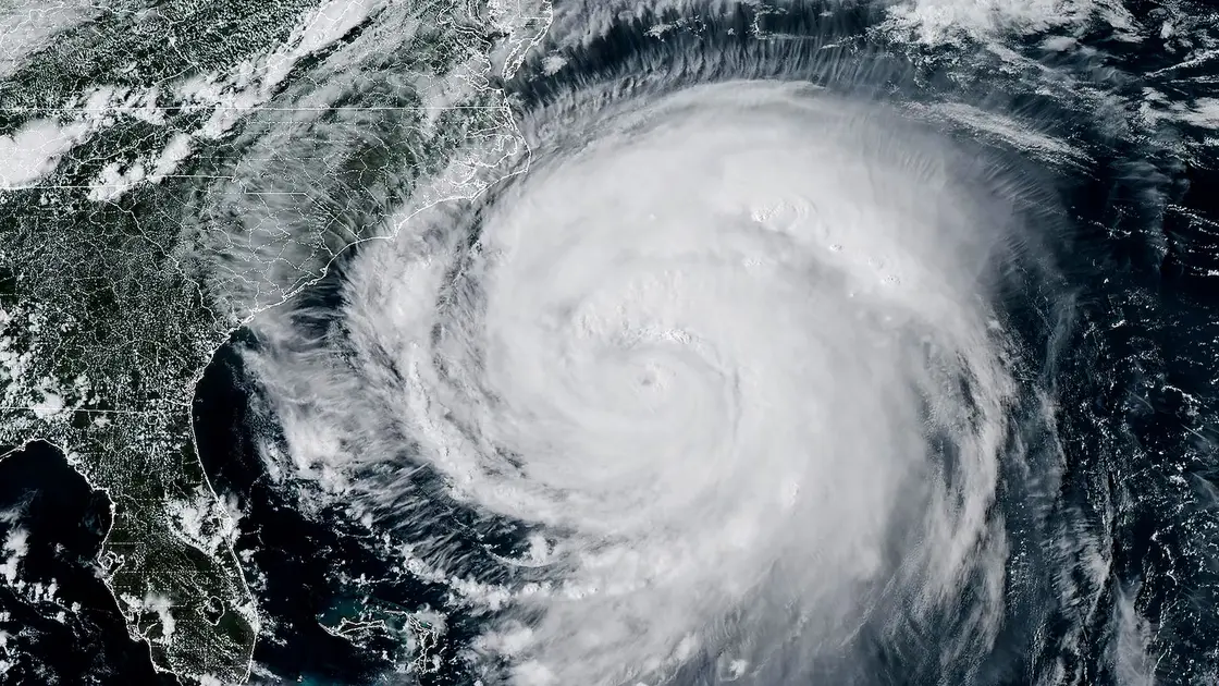
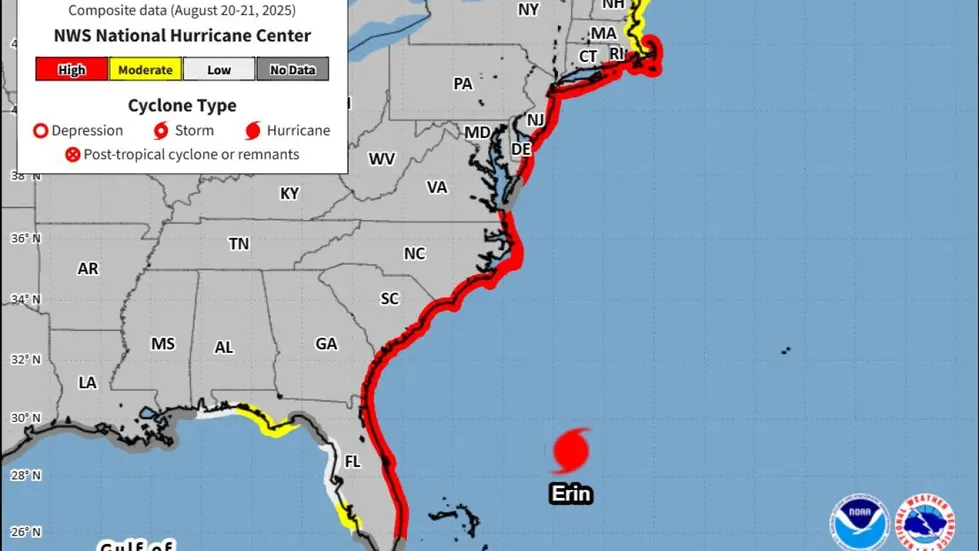
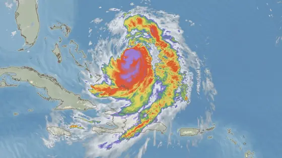
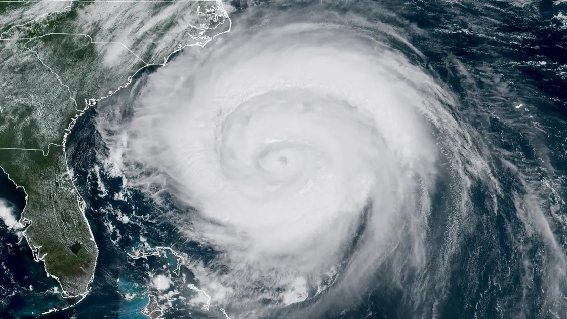
Hurricane Erin has intensified into a Category 4 storm with winds near 130 mph, and forecast guidance warns of dangerous surf and rip currents along the US East Coast later this week. The National Hurricane Center said outer bands have already affected the Virgin Islands and Puerto Rico, with tropical storm conditions expected for the Turks and Caicos Islands and southeast Bahamas as a precursor to broader impacts. Erin’s size means a wide wind field and rough seas could reach shore even without a direct landfall, complicating safety plans for coastal communities.
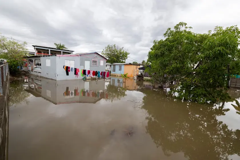
Dare County in North Carolina declared an emergency and ordered evacuations for Hatteras Island, signaling a step many barrier islands take when waves and winds threaten. Authorities warned that heavy surf and high winds could strand or wash out parts of Highway 12 and other coastal routes. Puerto Rico reported outages affecting about 147,000 customers, and more than 20 flights were canceled as the weather tightened. Ports in Puerto Rico and the U.S. Virgin Islands were reopened after conditions eased, but forecasters expect continued rough seas and the risk of flooding to linger as Erin moves northward and then northeast.
Scientists note that Erin’s rapid intensification aligns with broader climate trends that warm ocean waters and increase atmospheric moisture, potentially fueling storms that grow stronger and larger than in the past.
Key Takeaways
"You’re dealing with a major hurricane."
NHC assessment of storm strength
"The intensity is fluctuating."
NHC update on Erin’s strength
"Power was knocked out to about 147,000 customers."
Puerto Rico outages reported by Luma Energy
The episode highlights a reality many coastal areas face: protection costs rise as storms grow bigger and less predictable. Evacuations, emergency deployments, and disrupted travel strain budgets and local services, underscoring the need for resilient infrastructure and clear, timely communication with residents. At a policy level, Erin intensifies questions about how communities finance adaptation—sea walls, protective dunes, and storm-surge barriers—without shifting burdens onto ratepayers or taxpayers.
Beyond immediate safety, Erin signals a broader pattern of risk: storms that ripple through tourism, utilities, and transportation networks. If climate drivers keep amplifying these events, planners must translate warnings into durable planning and funding. The real test is turning today’s alarms into tomorrow’s safer, smarter coastal living.
Highlights
- You’re dealing with a major hurricane
- The intensity is fluctuating
- Power was knocked out to about 147,000 customers
- A dangerous hurricane in any event
Budget and public safety at risk as evacuations mount
The evacuations and emergency declarations tied to Erin raise budget concerns for local governments and utilities, while the potential for widespread disruption sparks political sensitivity and public reaction.
Resilience will be built not by fear but by planning that outlives the next storm.
Enjoyed this? Let your friends know!
Related News
Hurricane Erin updates
Hurricane Erin nears U S coast
Hurricane Erin hits the East Coast
Hurricane Erin Approaches Outer Banks
Hurricane Erin prompts dangerous rip currents along East Coast
Hurricane Erin danger grows on East Coast

Hurricane Erin nears US East Coast
Hurricane Erin Recurves Out to Sea