T4K3.news
Hurricane Erin updates
Erin threatens the East Coast; evacuations under way in North Carolina's Outer Banks as the storm approaches.

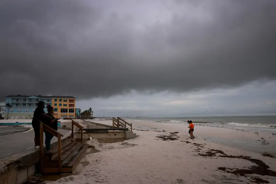
Parts of North Carolina's Outer Banks face mandatory evacuations as Erin threatens dangerous surf and possible prolonged flooding, even without a direct U.S. landfall.
Hurricane Erin tests U S coastal readiness as evacuations rise
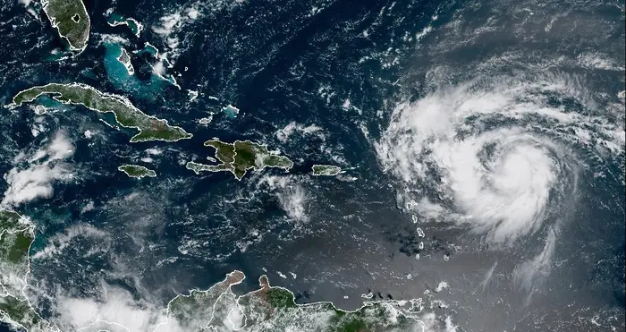
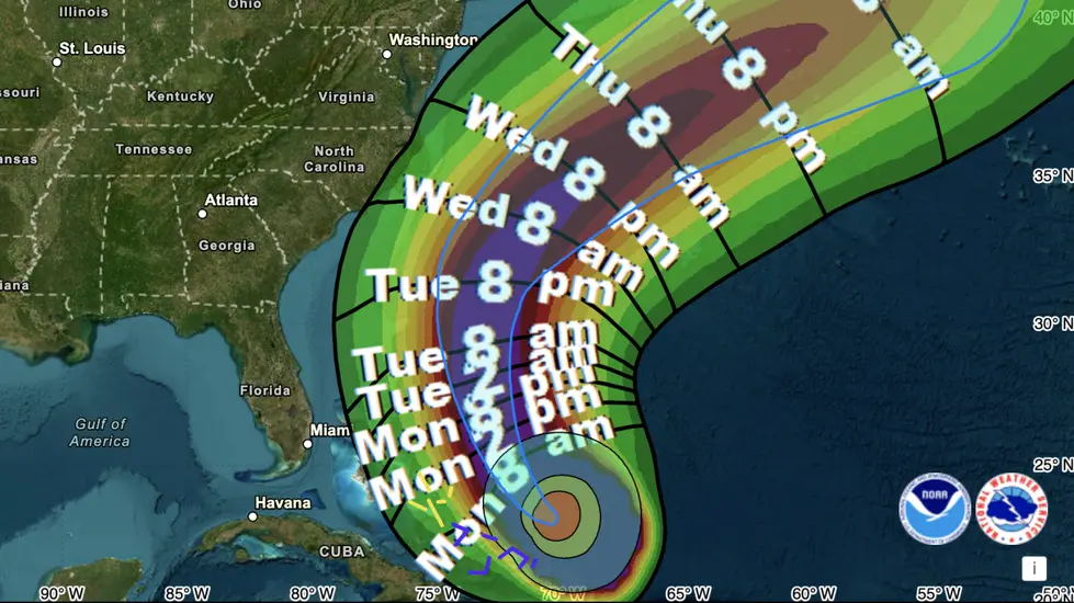
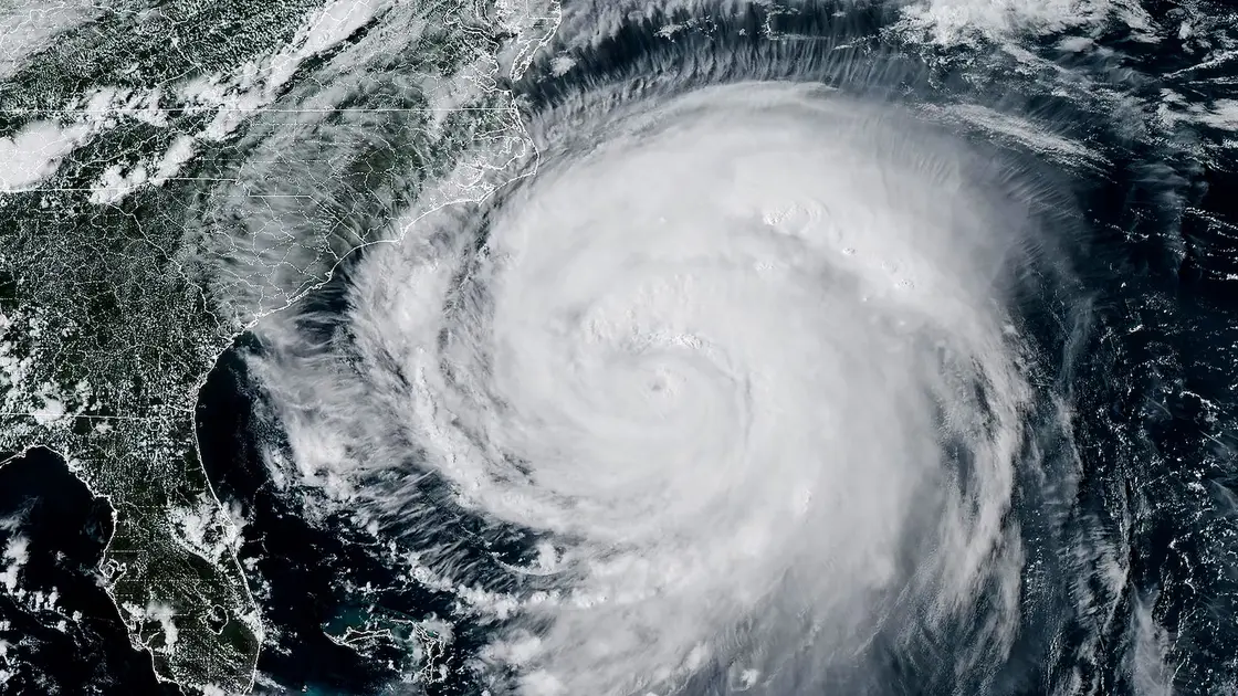
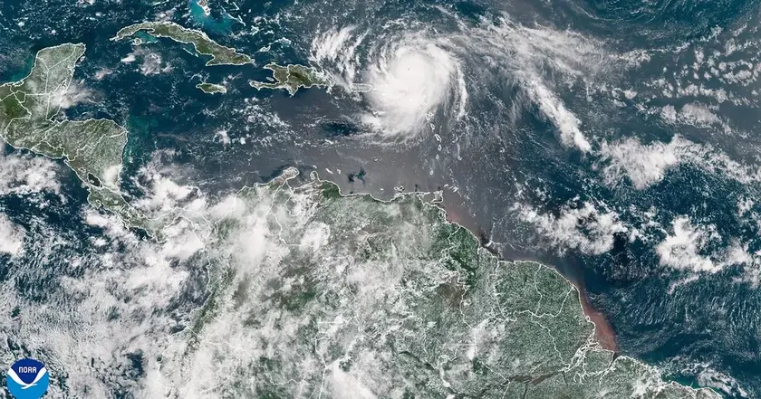
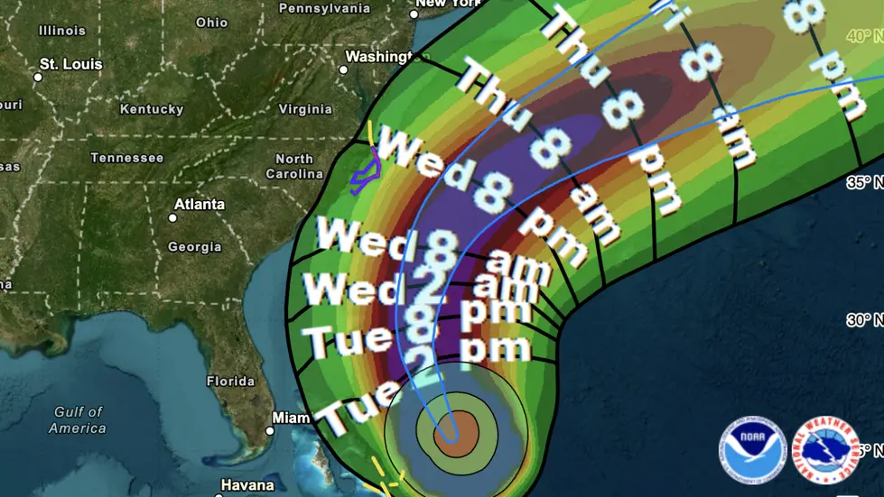
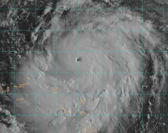
Hurricane Erin, a Category 4 storm with sustained winds near 140 mph, is moving toward the Bahamas and the United States. It is not forecast to make direct landfall in the United States, but forecasters warn of life threatening surf and rip currents along the East Coast for days. In North Carolina, officials issued mandatory evacuations for visitors to Ocracoke and Hatteras islands and declared emergencies in Dare and Hyde counties as the storm tracks northward. The conditions place a warning on Highway 12 and a risk of prolonged flooding in coastal communities.
The forecast shows Erin's core will pass east of the Bahamas and between Bermuda and the U S coast by midweek. The storm is expected to grow in size, increasing flood and wave risk even without a direct hit. Climate change is cited by experts as a factor behind stronger, wetter storms, heightening the importance of preparedness and robust evacuation plans.
Key Takeaways
"Coastal flooding will likely be a long duration issue, impacting Highway 12."
NWS warning cited in the article
"The core is expected to pass to the east of the southeastern Bahamas today and move between Bermuda and the east coast."
NHC forecast description
"Preparedness matters more than headlines when communities watch the sea rise."
Editorial takeaway about planning and safety
These events test how well coastlines can balance safety with the economic costs of evacuation. Local leaders must manage tourism disruption and the strain on road networks while keeping residents informed and safe. The approach also highlights gaps in communication and the need for clear, consistent guidance across counties and seasonal towns.
Erin shows that risk is not only about landfall; it is about waves, water and time. The public conversation should push for enduring investments in forecasting, communication, and infrastructure that can weather days of closure and storms that grow bigger even if they miss the shore.
Highlights
- The coast hears Erin and braces for the surge
- Evacuations today save lives tomorrow
- A storm grows larger even when it does not hit land
- Size and sea rise together in this storm
Public safety evacuations and coastal risk
The piece discusses mandatory evacuations and emergency declarations tied to a hurricane, raising concerns about public safety and resource allocation for coastal infrastructure and response efforts.
The coast will continue to respond to Erin as forecasts evolve.
Enjoyed this? Let your friends know!
Related News
Tropical Storm Erin poised to become major hurricane
Hurricane Erin Approaches Outer Banks

Erin update prompt
Storm Erin Remnants Metered for UK

UK weather could shift as Erin exits
Hurricane Erin nears U S coast

Storm Erin Shapes UK Weather Outlook
Hurricane Erin strengthens to Category 4