T4K3.news
Hurricane Erin danger grows on East Coast
Erin drives dangerous surf along the Outer Banks as a new tropical system forms behind it; evacuations are underway along parts of the NC coast.

Erin creates life threatening surf and evacuations on the North Carolina coast while a follow up tropical system gathers in the Atlantic.
Hurricane Erin brings dangerous surf to the Outer Banks as a new tropical system forms
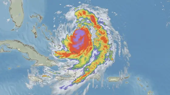
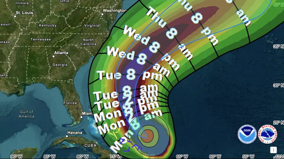
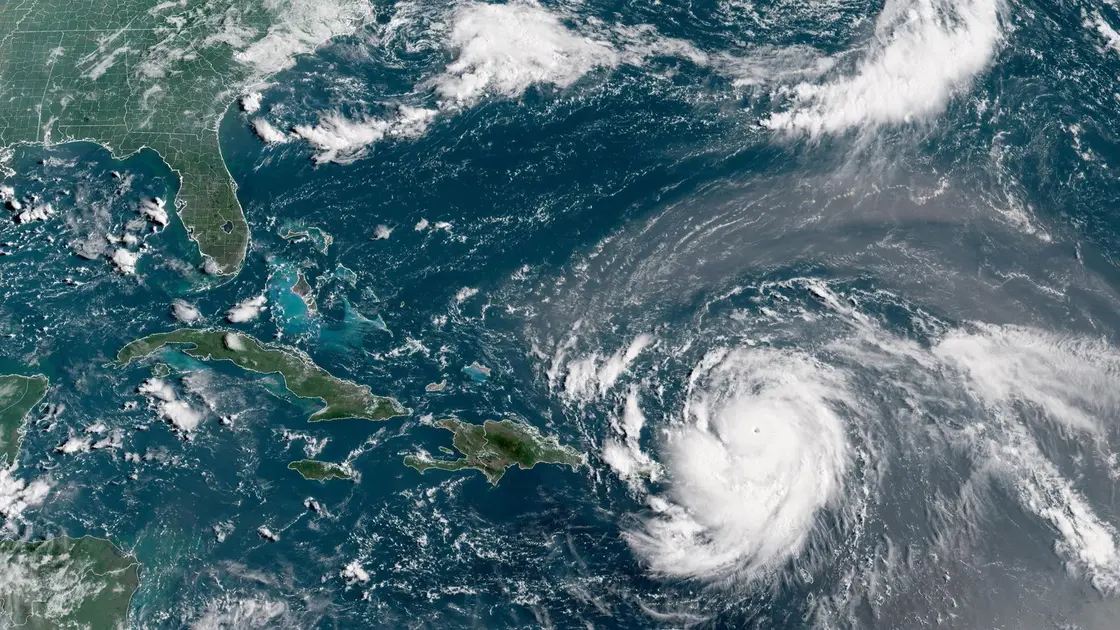
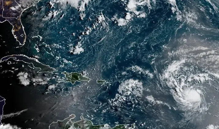
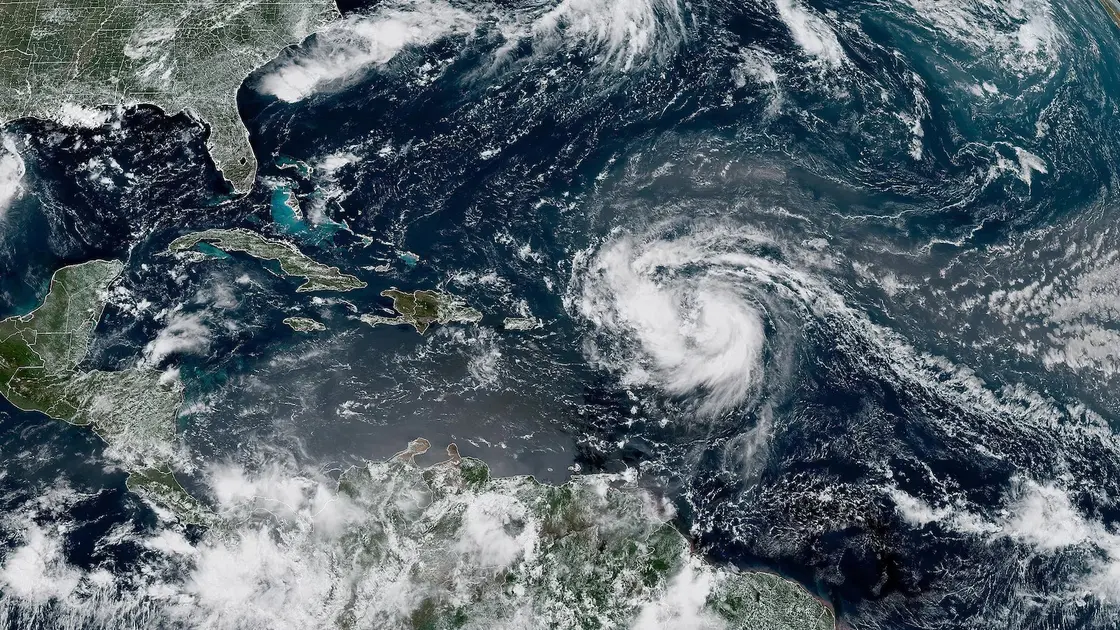
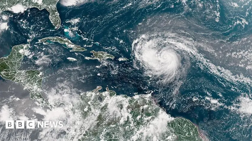
Hurricane Erin, a Category 3 storm, is not forecast to make landfall but will generate dangerous surf and rip currents along the East Coast. The Outer Banks face the highest risk, with forecasts calling for 20-foot waves and strong coastal flooding. In North Carolina, officials report at least 75 rip current rescues along the southern coast and Wrightsville Beach has a no swim advisory through Friday. A tropical storm watch covers parts of the coast from mid state to Kitty Hawk; Dare and Hyde counties have declared states of emergency and ordered evacuations for Hatteras and Ocracoke islands.
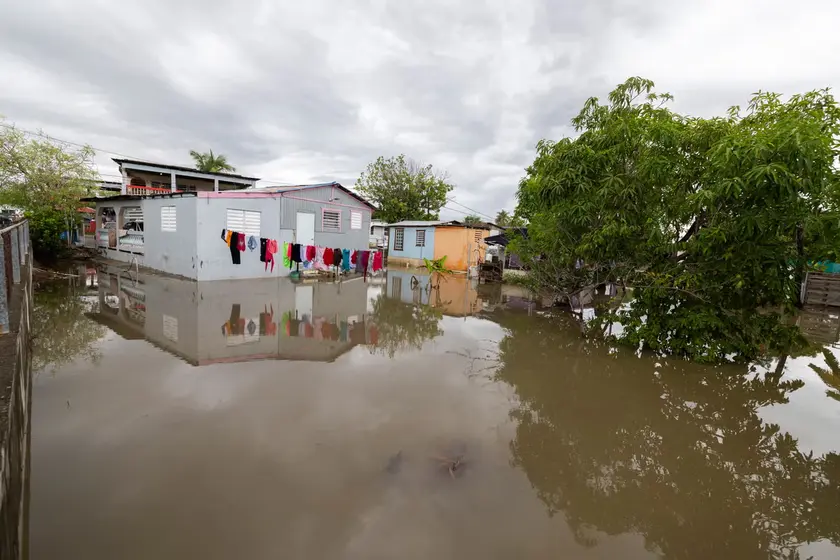
Beyond North Carolina, Erin’s outer bands affected Puerto Rico, the Turks and Caicos and the Bahamas, bringing flooding and power outages. The National Hurricane Center shows Erin’s reach extending up to 80 miles in hurricane force winds and up to 230 miles in tropical storm force winds. Forecasters say a tropical wave trailing Erin has a 60% chance of developing into a depression or storm in the next seven days, potentially becoming Fernand, while another disturbance off Africa has a small chance of development. The Atlantic is expected to stay active through August and September, with sea surface temperatures remaining well above average.
Key Takeaways
"Waves of 20 feet or more forecast this week will inundate and destroy protective dune structures"
National Weather Service warning for dune protection and coastal flooding
"Homes along the Atlantic Coast in Dare County are very vulnerable to collapse this week"
Cape Hatteras National Seashore official Dave Hallac on property risk
"Erin’s rapid intensification was a stark reminder of how quickly storms can strengthen"
Editorial note on rapid intensification pattern observed this season
"Forecasters expect above-average tropical activity this year"
Forecasts from meteorological agencies about seasonal activity
Erin’s rapid intensification from a tropical storm to a major hurricane highlights the volatility of this year’s season and the pressure on coastal authorities to act fast. Even without a direct landfall, the storm will reshape beach use, housing risk and emergency planning along a wide swath of the coast. The reach of Erin’s winds and the size of its surf remind communities that climate patterns are altering the cost and logistics of protection.
The coming days will test how well officials balance caution with normal life. Evacuations, beach closures and emergency declarations carry significant economic and social costs, especially for tourism towns that rely on coastal access. The broader forecast, including Fernand and other disturbances, means residents should stay prepared as the season continues to churn.
Highlights
- Waves of 20 feet or more forecast this week will inundate and destroy protective dune structures
- Homes along the Atlantic Coast in Dare County are very vulnerable to collapse this week
- Erin’s rapid intensification was a stark reminder of how quickly storms can strengthen
- Forecasters expect above-average tropical activity this year
Coastal evacuations and potential property risk
The forecast of 20-foot waves and dune destruction raises safety risks for residents and tourism businesses. Local authorities have declared emergencies and evacuation orders, underscoring the financial and human costs of extreme weather.
As Erin moves up the coast, communities must stay ready for the next wave of impacts and lessons learned from this season
Enjoyed this? Let your friends know!
Related News
Hurricane Erin prompts evacuations and dangerous waves
Hurricane Erin updates

Hurricane Erin remains dangerous
Hurricane Erin Category 5 reached

Hurricane Erin Rapidly Intensifies
Erin Could Become First Hurricane This Weekend
Erin becomes first Atlantic hurricane of season
Hurricane Erin Reaches Category Five