T4K3.news
Storm Erin Remnants Metered for UK
Forecasters warn of rain and winds as Erin's remnants approach the UK, with uncertainty growing closer to the weekend.

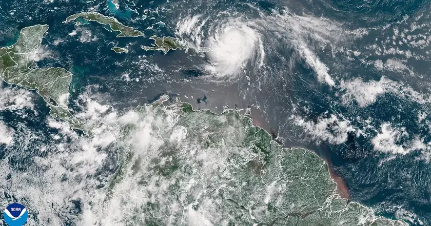
Remnants of Hurricane Erin could bring rain and gusty winds to parts of the UK later this week.
Met Office Warns Erin Remnants Move Toward UK
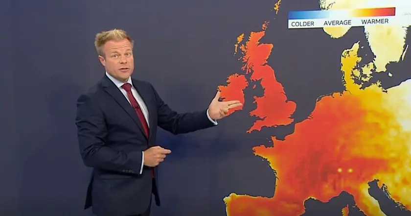
The Met Office issued a new warning as the remnants of Hurricane Erin move across the Atlantic. Erin was a major hurricane earlier in the season, but forecasters say the system is unlikely to directly strike the UK. Still, its influence could arrive as early as Sunday, bringing unsettled conditions.
The forecast calls for wind and rain, especially along the east coast, with heavier downpours and localized warnings possible later in the week. The update notes a shift from a dry spell toward more changeable weather, with temperatures staying near seasonal norms in many areas.
Key Takeaways
"Remnants travel farther than headlines"
standalone line on the reach of tropical systems
"Forecasts turn uncertain when storms fade from view"
reflection on forecast confidence
"Weather knows no calendar"
comment on how climate signals affect planning
"A distant hurricane can still reshape a week"
observation on practical impact
The warning shows how tropical systems can influence weather far from their origin. The forecast relies on shifting high and low pressure in the North Atlantic, highlighting the limits of precision at the edge of the season.
Public risk communication matters. When timing is uncertain, clear guidelines help people prepare rather than panic, and authorities must keep residents informed as details evolve.
Highlights
- Remnants travel farther than headlines
- Forecasts turn uncertain when storms fade from view
- Weather knows no calendar
- A distant hurricane can still reshape a week
Forecasts evolve; staying informed is the practical step.
Enjoyed this? Let your friends know!