T4K3.news
Hurricane Erin nears U S coast
Erin remains offshore but threatens large waves and coastal flooding along the East Coast.

Forecasts push Erin toward the U S East Coast with large waves and flood risk.
Hurricane Erin looms near coast with dangerous waves
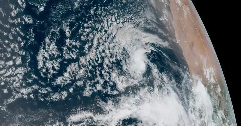
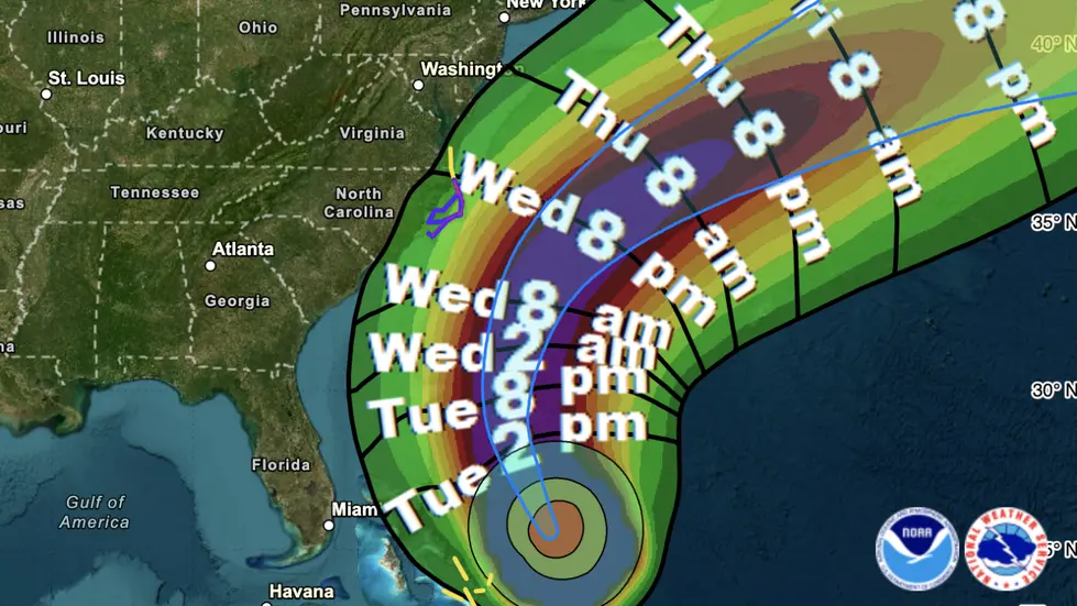
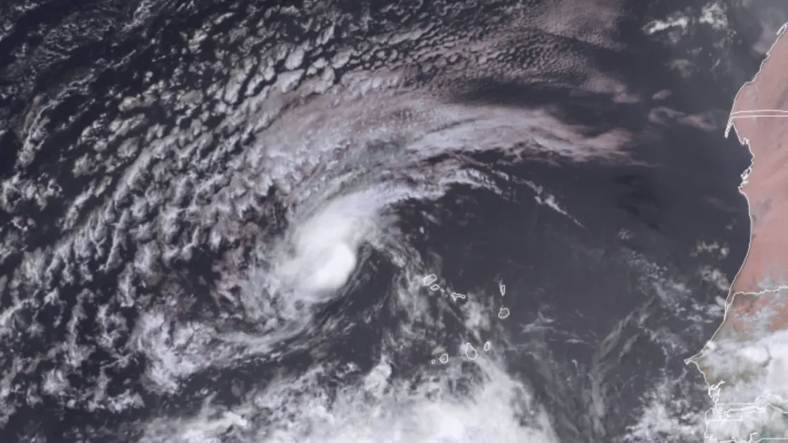
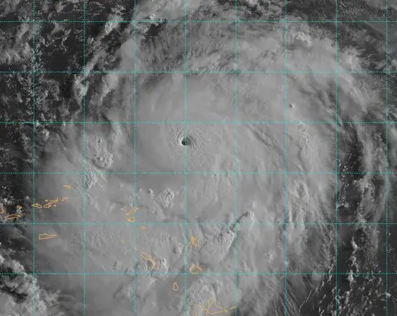
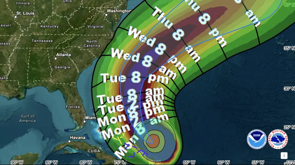
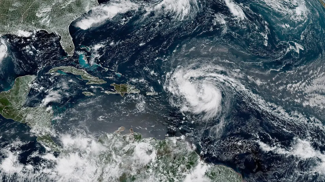
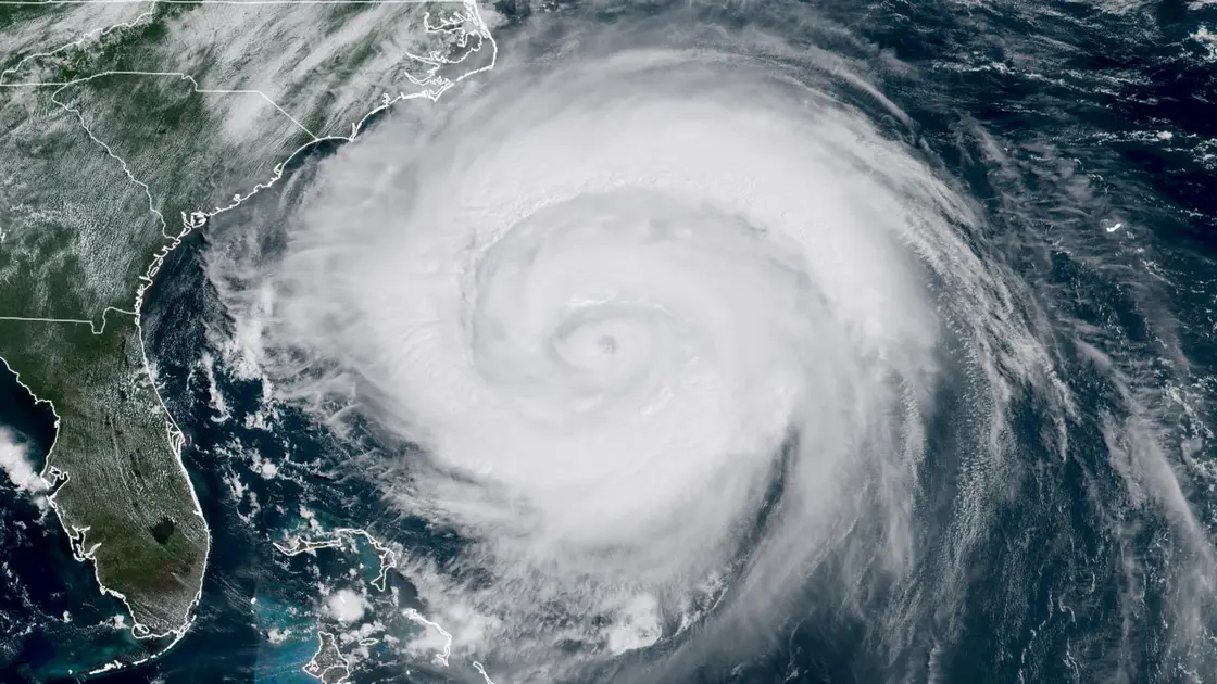
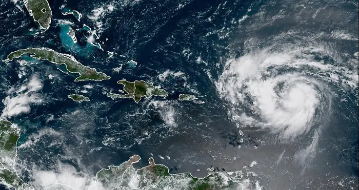
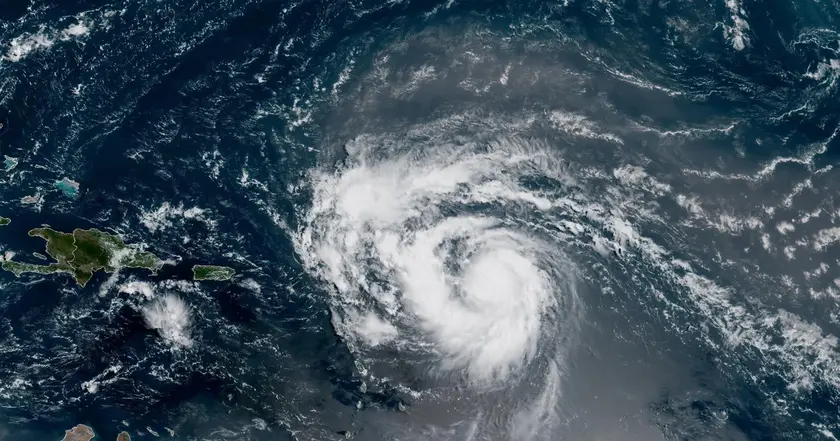
Hurricane Erin remains offshore and is moving toward the United States East Coast. As of 11 am ET it was about 690 miles south southeast of Cape Hatteras North Carolina, traveling northwest at 9 mph with maximum winds around 105 mph. The storm is not expected to make landfall, but its unusually large size means a wide wind field and high waves that could affect a broad stretch of coastline. A dangerous surf risk and potential flood threats are in play along many beaches. A tropical storm warning is in effect for the Outer Banks from Beaufort Inlet to Duck, and a storm surge warning covers the coast from Cape Lookout to Duck. Evacuation orders cover Hatteras and Ocracoke islands to prevent people from being caught by rising water. Officials warn that roads in low lying areas will likely flood for days once waters arrive. Experts note that Erin may reshape beaches and dunes even without a direct landfall, underscoring that the threat comes from the size of the storm as much as from its winds. Climate and coastal scientists also point to a pattern where larger storms are linked to higher surge and broader impact across shorelines.
Key Takeaways
"The size of the storm really is correlated with higher storm surge levels over larger swaths of area"
Expert explanation of surge risk
"Beaches may wash over dunes and form new sandbars"
Forecast discussion on beach changes
"Leave now and avoid getting caught by rising water"
Public safety guidance
The focus on Erin’s size challenges the typical headlines that chase peak wind speeds. A monster wind field expands risk far from the center and makes surge and erosion the dominant threats. This episode tests how officials communicate danger without normal landfall anchors and it tests the budget and resources of small coastal communities already stretched thin. The situation also fits a broader climate narrative, with experts saying storms may become more intense even as overall hurricane counts fluctuate. Preparedness will matter as much as forecasts in limiting harm and speeding recovery.
Highlights
- Size matters more than wind when it comes to coast damage
- The storm is hundreds of miles across and still reshaping the shore
- Leave now before the water covers the road
- Coastlines remember big storms long after the winds fade
Public safety and evacuation costs
Hurricane Erin highlights the need for large scale safety messaging and potential budget strains as communities prepare for evacuations and cope with flood and erosion impacts. The storm size increases exposure across a broad area and may complicate response efforts.
The sea writes its own timetable, and preparedness remains the best defense.
Enjoyed this? Let your friends know!
Related News
Erin set to strengthen into major hurricane
Hurricane Erin strengthens to Category 4
Hurricane Erin updates
Erin becomes first Atlantic hurricane of season
Hurricane Erin Recurves Out to Sea
Hurricane Erin strengthens toward major hurricane
Hurricane Erin forms in Atlantic

Hurricane Erin remains dangerous