T4K3.news
Hurricane Erin brings unsettled weather to the UK
Ex-hurricane Erin’s approach could bring rain and strong winds midweek after a sunny Bank Holiday weekend. Monitor official updates.

Forecasters warn a shift from sun to unsettled conditions as Erin nears, with possible effects on the Bank Holiday weekend
Hurricane Erin heading to the UK bringing unsettled weather
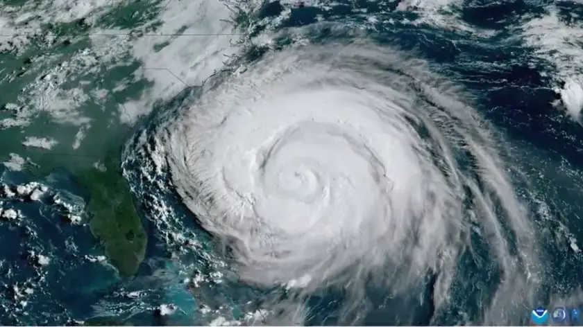
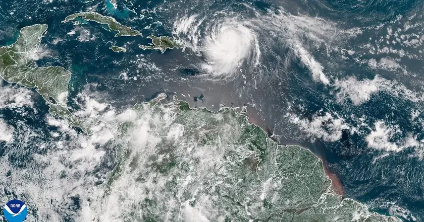
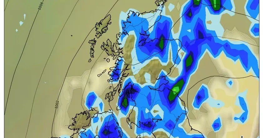
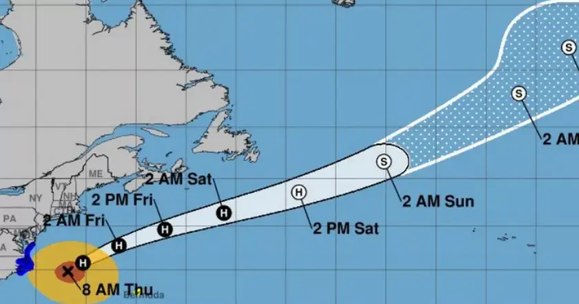
Hurricane Erin remains a category two storm in the North Atlantic, moving eastward. While a direct landfall as a hurricane is unlikely for the UK, forecasters say its remnants could alter the pattern of weather here starting midweek. The Met Office notes that the exact track is still uncertain, which means the scale of impact depends on where the system goes next. For most of the Bank Holiday weekend, sunshine is still expected with dry and warm conditions, around 24 to 25 C in parts of the south and east.
By Tuesday or Wednesday, bands of rain and stronger winds may spread from west to east as the ex-hurricane bends toward Europe. Warning signs include heavy rainfall in some western areas and large waves on western coasts, potentially posing hazards for holidaymakers and surfers. Officials urge people to monitor updates and follow safety guidance, as the forecast could shift with the storm's evolving path.
Key Takeaways
"There is still a lot to work out in terms of the exact track and position of what will become ex-Hurricane Erin."
Met Office deputy chief meteorologist Tony Wisson on forecast uncertainty.
"For festivals and outdoor events, the weather should not cause any disruption."
Tom Morgan on Bank Holiday expectations.
"Ex-hurricane Erin will bring quite a large swell in the sea."
Weather warning about waves from Tom Morgan.
Forecasts about Erin expose a modern tension in weather reporting: confidence fades as complexity grows. The UK weather system requires clear, cautious language because many people plan their Bank Holiday around accurate forecasts. The piece shows how meteorologists balance optimism about sunshine with the risks of disruption, a delicate dance between information and public reassurance.
This incident also highlights the impact of climate variability on travel and leisure. Even a storm far at sea can ripple through coastal economies and event planning, underscoring the need for flexible schedules and robust warning systems. In short, the best response is ordinary caution: check updates, pack accordingly, and respect safety advisories.
Highlights
- Ex-hurricane Erin will bring large swells to the western shores.
- The track is still in flux, so plans must stay flexible.
- Bank Holiday sun now, unsettled weather ahead.
- Forecasts can change; stay tuned to official updates.
Coastal hazard and travel disruption risk ahead
Erin’s remnants could bring heavy rain, gusty winds and large waves to western coasts, posing coastal hazards and possible disruption to outdoor events and travel plans. Public safety advisories may be needed as conditions shift.
Forecasts will sharpen as Erin's path becomes clearer
Enjoyed this? Let your friends know!
Related News

Hurricane Erin expected to bring unsettled weather to Norfolk next week

UK weather could shift as Erin exits
Storm Erin Remnants Metered for UK
Erin remnants threaten Scotland

UK heat on bank holiday Monday
Weather update Erin'

Storm Erin update reaches UK

Storm Erin Shapes UK Weather Outlook