T4K3.news
Erin remnants threaten Scotland
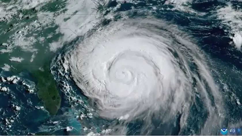
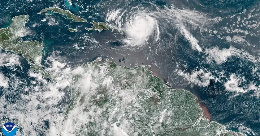
Ex-hurricane Erin could bring wind and rain to parts of the UK next week.

Forecasters warn that the remnants of ex-hurricane Erin could bring rain and stronger winds to the UK later this month.
Met Office warns Erin remnants threaten Scotland with rain and wind
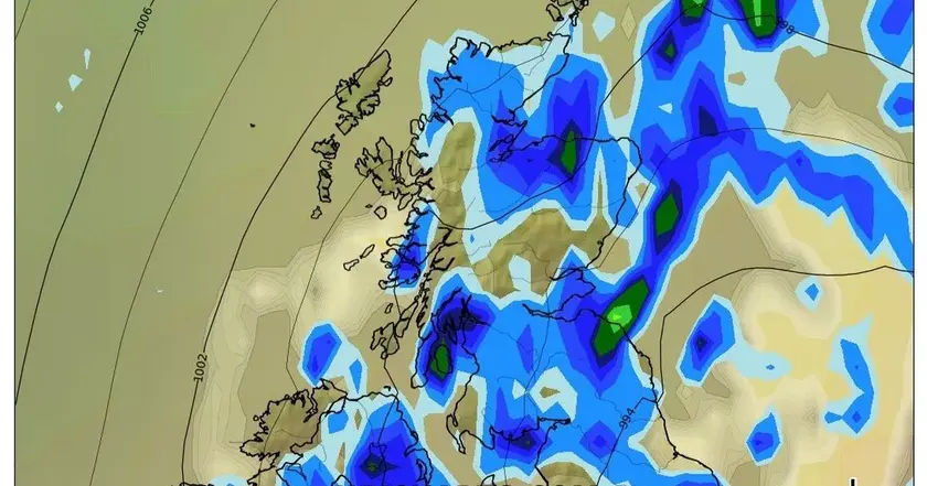
The Met Office has issued an updated outlook on how ex-hurricane Erin might affect UK weather in the coming days and weeks. Erin moved from the US East Coast and has left a trail of uncertainty as forecasters try to map its remains across Europe. Models suggest a band of rain could reach western parts of Scotland by the end of August, with showers and stronger winds possible elsewhere as the system interacts with other weather drivers.
Forecasts remain uncertain because Erin’s behavior is hard to pin down at long range. Forecasters note a potential changeable pattern, with periods of dry spells at times giving way to rain and unsettled conditions as the week progresses. Weather services in the UK also caution that confidence in these long range predictions is low and could shift quickly as new data arrive.
Key Takeaways
"Majority of this period comes with lower than average confidence, even accounting for the long range."
Met Office note on forecast uncertainty
"This is due to large uncertainties surrounding the behaviour of ex-hurricane Erin at the beginning of the forecast and its subsequent impact on the large scale weather pattern over the UK."
Met Office explanation for uncertainty
"Probably beginning fine for the vast majority of areas, but a band of rain, already in or threatening the west, is likely to move slowly east."
Forecast pattern described by Met Office and forecast maps
"Temperatures will be above to well above normal at first with a gradual decline after midweek but an increase in humidity."
BBC Weather outlook quoted in article
Forecasts from the Met Office and BBC Weather emphasize how a weak, decaying tropical low can still upend routine weather expectations. This points to a broader trend: a warming climate makes ex tropical systems linger longer and interact with mid latitude forces, increasing forecast complexity. The public should view updates as evolving guidance, not a fixed forecast, and prepare for rapid changes in rain, wind and temperature. At the same time, the coverage reflects how meteorology is balancing caution with clear warnings, a tension that matters when people plan travel, outdoor events or work outside.
Beyond the weather itself, the discussion highlights an ongoing policy conversation about communicating risk amid climate change. When forecasters say confidence is low, it is a reminder that climate signals require careful translation into practical guidance for communities and stakeholders. The message should be accurate, not alarmist, and timely enough to help people respond without panic.
Highlights
- Majority of this period comes with lower than average confidence
- This is due to large uncertainties surrounding the behaviour of ex-hurricane Erin
- Probably beginning fine for the vast majority of areas, but a band of rain is likely to move slowly east
- Extreme weather has become a new normal due to climate change
Climate-linked forecast uncertainty risks public confusion
The piece ties weather outlook to ex-hurricane Erin and climate change messaging, which could provoke public reaction and policy scrutiny. Forecasters warn of low confidence, highlighting potential confusion if updates shift rapidly.
Forecasts will keep evolving as Erin moves, and readers should stay tuned for updates.
Enjoyed this? Let your friends know!
Related News

UK bank holiday sun gives way to Erin rain

Weather update
Hurricane Erin brings unsettled weather to the UK
Storm Erin Remnants Metered for UK

UK weather could shift as Erin exits

Hurricane Erin expected to bring unsettled weather to Norfolk next week

UK heat on bank holiday Monday

UK faces fourth heatwave