T4K3.news
New SWOT data boosts tsunami forecasts
NASA and CNES SWOT observations improve tsunami forecasting and warning accuracy after Kamchatka quake.

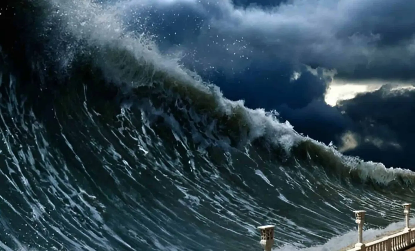
A state-of-the-art satellite captured the leading edge of a Pacific tsunami following a powerful Kamchatka earthquake.
Satellite records tsunami triggered by Kamchatka quake
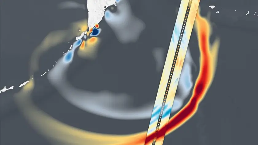
A magnitude 8.8 earthquake struck off Russia's Kamchatka Peninsula in late July, one of the strongest quakes on record. The resulting tsunami sent waves across the Pacific and prompted warnings and evacuations. The SWOT satellite, a joint NASA CNES mission, captured the leading edge of the wave about 70 minutes after the quake, showing places where the water rose more than 1.5 feet. Scientists note that even modest open ocean waves can grow into tall surges near coastlines.
The data are feeding NOAA centers that forecast tsunamis and alert coastlines. SWOT measured the height, shape and direction of the waves and helps researchers reverse engineer the cause of a tsunami. The team says the information matched the NOAA forecast results and could strengthen future predictions.
Key Takeaways
"A 1.5-foot-tall wave might not seem like much, but tsunamis are waves that extend from the seafloor to the surface of the ocean"
Ben Hamlington, NASA JPL oceanographer
"What might only be a foot or two in the open ocean can become a 30-foot wave in shallower water at the coast"
Ben Hamlington, NASA JPL oceanographer
"The satellite observations help researchers to better reverse engineer the cause of a tsunami, and in this case, they also showed us that NOAA forecast was right on the money"
Josh Willis, NASA JPL oceanographer
"It suggests SWOT data could significantly enhance operational tsunami forecasts"
Vasily Titov, NOAA Center for Tsunami Research chief scientist
This event highlights how satellites are becoming essential tools in disaster response. By turning space data into practical forecasts, agencies can protect more coastal communities and save lives.
The trend also raises questions about funding and preparedness. As climate risks grow, steady investment in spaceborne ocean observations matters for early warnings and longer term resilience.
Highlights
- From space to shore data saves lives
- Big science maps a dangerous ocean
- Satellite tools sharpen the forecast that protects coasts
- Calm satellites measure a violent sea
As data streams grow, forecasts may become more precise and coastal communities safer.
Enjoyed this? Let your friends know!
Related News

Markets Rally on CPI Beat Spurs Fed Rate Cut Bets

Mortgage approvals increase as housing market stabilizes

UK construction activity sees sharpest drop in five years

Federal Reserve keeps interest rates unchanged

Markets Rally on Inflation Data

Rolls-Royce profits rise 50% amid AI and defense demand

Stocks Decline as Powell Shares Outlook on Interest Rates

Nvidia stock set for new high after China license deal