T4K3.news
Satellite images show flood damage in Uttarakhand
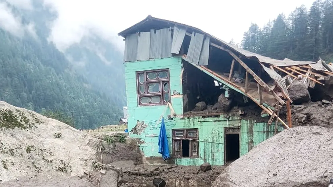
Before and after satellite images from Isro reveal the extent of damage in Dharali village after flooding on August 5


BBC Verify examines how satellite data confirms damage from floods in Uttarakhand and what it means for rescue work.
Satellite evidence maps flood damage in Uttarakhand
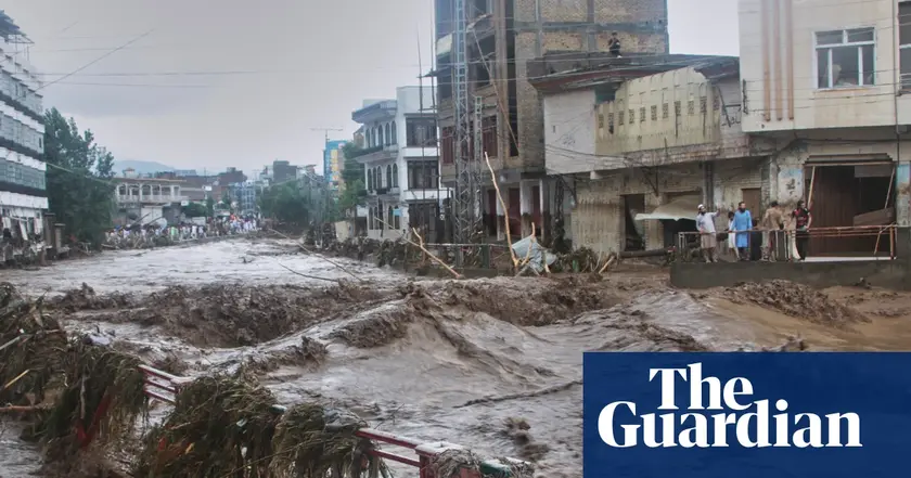
Isro released satellite images showing the aftermath of flooding in Dharali village in the hilly state of Uttarakhand. A comparison of images from 13 June last year and 7 August this year shows a fan shaped deposit of debris and sediment after the flooding on 5 August. Several buildings, a patch of green vegetation and a road with a small connecting bridge have disappeared and are likely submerged or swept away by the mud flow and debris, Isro said. BBC colleagues reporting from the area say the affected zone is inaccessible because roads are damaged. The floods triggered by a cloudburst have left more than 100 missing. The Indian army has continued rescue operations and is providing medical aid.
Key Takeaways
"Satellite images are a new kind of eyewitness"
highlighting the role of satellite data in disaster assessment
"When roads vanish, data becomes lifelines"
illustrating how data guides relief planning
"Fact checking keeps relief on track"
editorial stance on verification in reporting
"Trust rides on clear evidence not rumors"
closing note on public confidence
BBC Verify’s report shows how satellite data can verify events when ground access is difficult. The images offer a snapshot of scale and change that can guide relief teams and inform the public. Yet satellite data must be paired with on site reporting to avoid overreliance on a single perspective. The piece also exposes the tension between rapid information and confirmed facts in disaster zones, where details evolve by the hour. In short, space born evidence is a powerful tool, but it needs careful interpretation and timely updates.
Highlights
- Satellite images are a new kind of eyewitness
- When roads vanish, data becomes lifelines
- Fact checking keeps relief on track
- Trust rides on clear evidence not rumors
Evidence moves from space to street, shaping how we respond to floods.
Enjoyed this? Let your friends know!
Related News
Verified video confirms flooding in Indian village
BBC Verify confirms Indian flood footage
Flash floods update
Rescue efforts continue after Kashmir floods claim 56 lives
Israeli air strikes in Lebanon confirmed
Wildfire smoke forecasting tools reviewed

California hit by rapid quake swarm
Scotland faces two days of thunderstorms