T4K3.news
Massachusetts Maps EEE and West Nile Risk by Town
State health data show town level risk for EEE and West Nile; map will be updated as new data arrive.

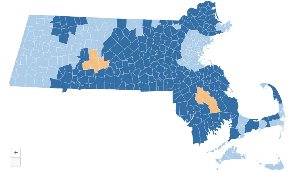
One town by town map shows where EEE and West Nile risk exists, based on mosquito data.
Massachusetts Maps EEE and West Nile Risk Across Towns
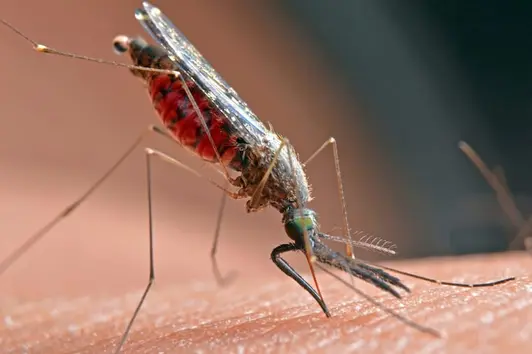
Massachusetts public health officials released a town by town risk map for Eastern Equine Encephalitis and West Nile virus. The map uses mosquito testing data and will be updated as new results arrive. So far this summer there have been no reported human cases of mosquito borne illnesses. Last year there were four human EEE cases in Massachusetts, the first such cluster since 2020.
Risk levels for EEE range from Remote to Critical, while West Nile uses Low to Critical. The map serves as a guide for prevention and awareness, not a forecast. Officials emphasize ongoing surveillance and remind residents to protect themselves and remove standing water as the season continues.
Key Takeaways
"No humans have tested positive for mosquito-borne illnesses this summer"
State surveillance data show no human infections yet this season
"EEE can be deadly and outbreaks can last for several summers"
Massachusetts Department of Public Health notes the severity and cyclical pattern
"Cases of mosquito-borne diseases are down this year"
Public health data indicate declines compared with last year
"Public health data balance transparency with calm"
Editorial note on communicating risk to residents
The data provides clear, actionable information for residents, but it also highlights the limits of maps in a changing climate. Mosquito borne risk shifts with weather, land use and human activity, so towns must pair the map with local outreach and practical steps.
Beyond numbers, the map tests how public health communicates risk. Clear definitions help, yet the real goal is to keep people safe without causing alarm. Local leaders should translate data into concrete guidance for families and outdoor workers as the season unfolds.
Highlights
- Town level risk mapping helps families plan simple safeguards
- No human cases yet this summer offers a pause not a promise
- Data driven maps aim to inform not alarm residents
- Updates will come as new data arrive
Ongoing updates will show how risk shifts with the season.
Enjoyed this? Let your friends know!
Related News

Mosquitos in Massachusetts test positive for EEE virus

West Nile virus cases reported in multiple states

Second case of EEE confirmed in Massachusetts

Kremlin presses Donetsk surrender in ceasefire offer

Russian offensive campaign assessment updates
Lee Fire update

Chikungunya outbreak forces new tactics in Foshan

Three dead birds test positive for West Nile virus